
Can Capella-2 See Through Walls? What SAR Satellites Really Show
Capella-2 cannot see into homes. Learn why Tokyo’s radar image looked transparent, what SAR really detects, the meaning of 50 cm resolution, and what changed by 2026.
Contents
- Can Capella-2 see through walls or inside a home?
- Why did the Tokyo skyscrapers appear transparent?
- How does synthetic-aperture radar actually work?
- What can commercial SAR satellites really observe?
- What does 50-centimeter resolution mean—and what does it not mean?
- SAR versus an optical satellite image
- A five-step checklist for interpreting a radar image
- From Capella-2 in 2020 to the constellation in 2026
- Can InSAR measure ground motion to millimeter precision?
- What are the real privacy implications?
- Can Capella radar see underground tunnels?
- Why SAR remains useful despite these limits
- Frequently asked questions
- Can Capella-2 identify people in a house?
- Can Capella-2 take images at night?
- Does 50 cm resolution mean the satellite can read small objects?
- Was Capella-2 still Capella’s newest satellite in 2026?
- Can SAR image underground tunnels?
- Bottom line
- Primary technical sources and actual SAR images
- Related reading on Horus Valley
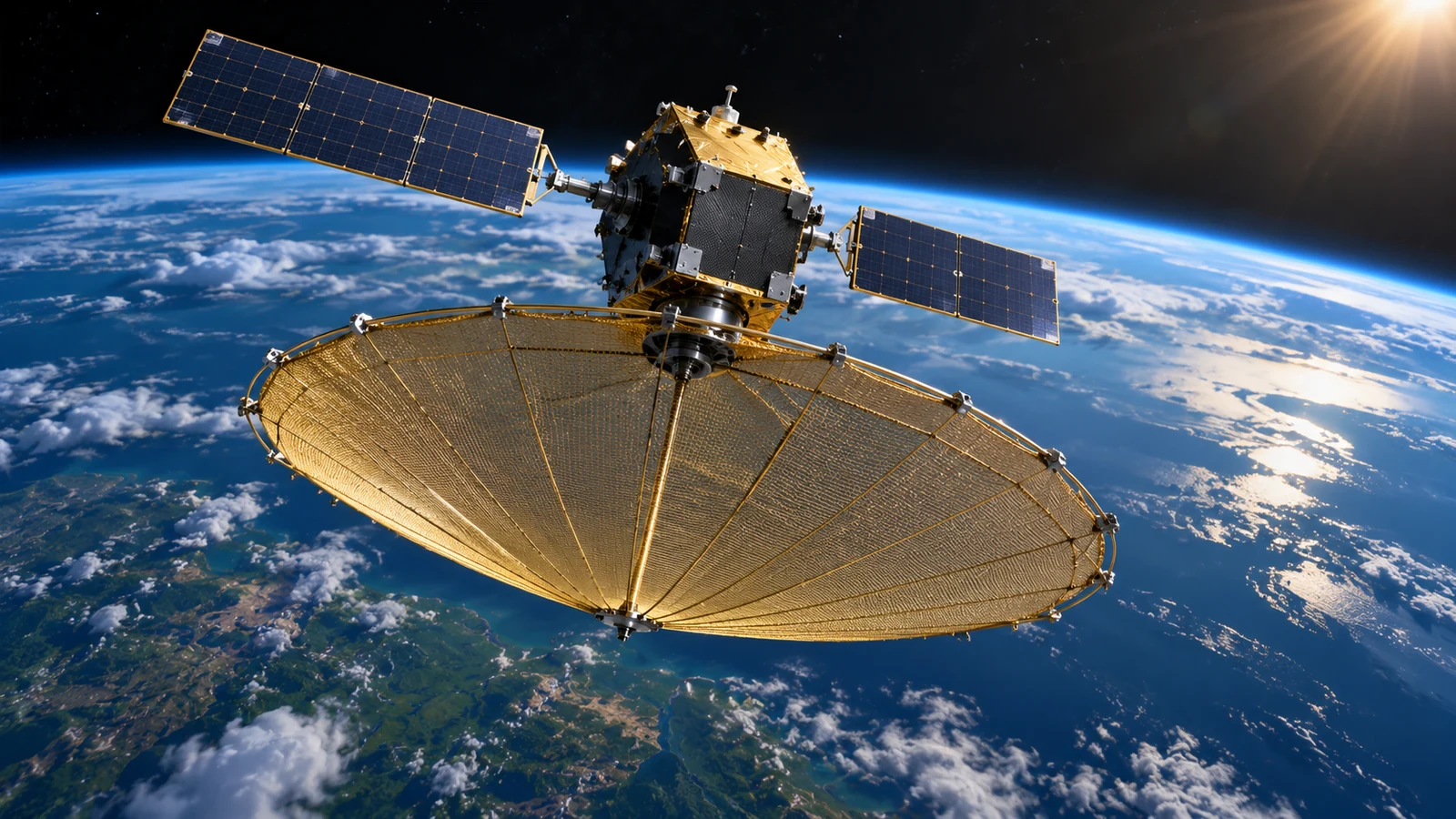
Capella-2 cannot see people inside houses or take pictures through walls. The headline that made the satellite famous in 2020 confused radar-image distortions with a capability that Capella Space explicitly rejected. What the spacecraft could do was important in its own right: use synthetic-aperture radar (SAR) to image Earth’s surface by day or night, often through clouds, and resolve outdoor structures at unusually fine scales. This guide explains what those images actually show, how to avoid misleading interpretations, and how Capella’s constellation evolved through November 2026.
The spacecraft was named Capella-2, previously Sequoia, and was launched in 2020. In December of that year Capella unveiled SAR products with a stated spatial resolution of 50 × 50 centimeters. This was not a conventional camera capable of looking into rooms. In response to sensational coverage, the company published a direct rebuttal about the supposedly transparent buildings in its radar imagery.
Can Capella-2 see through walls or inside a home?
No. In a statement dated December 18, 2020, Capella Space said its SAR instrument cannot image the interior of buildings through walls or roofs. Its ability to operate through cloud cover is a different physical question. Although radio signals can interact with and, in some settings, penetrate certain materials, that does not mean a satellite’s radar has the imaging geometry, penetration and usable signal needed to reconstruct rooms behind ordinary building walls.
The viral image in question showed the Chiyoda district of Tokyo. Some skyscrapers appeared strangely transparent or interwoven. The company explained that this appearance resulted from radar layover rather than an X-ray-like view. See the company’s original correction and annotated Tokyo example.
Why did the Tokyo skyscrapers appear transparent?
SAR is a side-looking ranging instrument. Radar echoes arrive according to their distance from the spacecraft, rather than the familiar perspective of an ordinary photograph. A tall building’s upper floors can be closer to the radar than parts of the ground or nearby structures. When echoes from different elevations map into the same output region, they can overlap. This geometrical distortion is called layover. It can make separate outdoor structures seem to occupy the same place, but it does not reveal the interiors of those structures.
NASA describes the same interpretation problems in its SAR overview, including layover, foreshortening, and radar shadow. Without knowing the sensor’s viewing direction and the object’s height, even an apparently sharp radar image can be misread. Radar imagery is not a black-and-white optical photograph.
How does synthetic-aperture radar actually work?
- Transmit: A radar instrument sends microwave pulses toward an area of Earth.
- Receive: The instrument records echoes returned by terrain, water, buildings and other surfaces; the strength and character of an echo depend on the material, roughness, moisture and viewing geometry.
- Use motion: As the satellite passes the target, it collects repeated observations and processes their phase histories to synthesize a much larger antenna aperture.
- Form an image: Signal processing creates a map of radar backscatter and associated measurements—not an image of visible colours.
Capella’s spacecraft use X-band SAR. Its sensor documentation lists frequencies around 9.4–9.9 GHz, with acquisition modes including Spotlight and Stripmap. Since the instrument provides its own illumination, nighttime is not the obstacle it is for ordinary sunlight-dependent cameras. Clouds often pose far less obstruction, although heavy rain, surface moisture, radar geometry and signal quality can still affect a collection.
What can commercial SAR satellites really observe?
| Target or condition | Plausible SAR output | What it does not establish |
|---|---|---|
| Cloud cover or nighttime | Earth-surface imaging without visible daylight | Perfect results in every severe storm |
| Roads, ports and airports | Shapes of major outdoor structures; changes across dates | Reading car plates or watching occupants inside vehicles |
| Ships at sea | Detectable objects and changes under suitable conditions | Guaranteed detection of every vessel |
| Tall buildings | Exterior returns that can be distorted by viewing geometry | A view through exterior walls into rooms |
| Ground deformation | Repeat-pass phase comparisons using suitable InSAR data | Direct millimeter-scale photographs of tiny objects |
What does 50-centimeter resolution mean—and what does it not mean?
Capella’s December 2020 announcement described a 50 cm × 50 cm SAR capability under particular acquisition conditions. Spatial resolution, pixel spacing and object identification are different concepts. Even if a structure produces radar returns over several pixels, there is no guarantee that the image reveals its precise identity, its contents or fine printed details. SAR responses are based on radio-wave scattering rather than a visible-light camera zooming in on a person.
Specifications also vary by satellite generation and imaging mode. NASA’s Commercial Satellite Data Acquisition page lists several Capella products, including an ultra-high-resolution Spotlight category rated at 0.25 meters for a later constellation. It would be incorrect to attribute every 2026 specification to the original Capella-2 satellite.
SAR versus an optical satellite image
| Question | Optical imaging | Synthetic-aperture radar |
|---|---|---|
| Where does illumination come from? | Usually reflected sunlight | Microwave pulses sent by the radar |
| Can it work at night? | Not in the same way without adequate light | Yes |
| Can it work through clouds? | Clouds often obscure surface details | Frequently, within practical weather limits |
| What do the pixels represent? | Light measured in visible or other optical bands | Radar backscatter, phase and processed signal features |
| What can mislead analysts? | Shadows, haze and cloud cover | Layover, foreshortening, radar shadow and speckle |
A five-step checklist for interpreting a radar image
- Identify the sensor, capture date, imaging mode and stated resolution before drawing conclusions.
- Check the look direction; high buildings and steep slopes can appear displaced toward the radar.
- Do not treat dark areas as visible underground voids: water reflections, radar shadow or other surface effects may be responsible.
- Use a corresponding optical image or a second radar acquisition to verify an apparent change in a port, road or building.
- Separate detection from identification: seeing a bright or dark return does not automatically tell you the precise object or its activity.
For a genuine example rather than a reconstruction, compare Capella’s December 2020 original SAR image release with the Tokyo layover correction. The official pages include real radar imagery. The featured spacecraft illustration supplied with this guide is conceptual, not a photograph of Capella-2 or a genuine SAR data product.
From Capella-2 in 2020 to the constellation in 2026
| Date | Verified milestone | Why it matters |
|---|---|---|
| 2020 | Launch of Capella-2/Sequoia and 50 cm imagery announcement | Early commercial high-resolution SAR demonstration |
| 2025 | Updated product specifications and Acadia-generation data offerings | Specifications must be compared by product and spacecraft |
| May 4, 2026 | Commercial InSAR-ready image products announced | Enables suitable users to process repeated phase observations |
| October 20, 2026 | Launch of C-21 (Acadia-11) and C-22 (Acadia-12) | Expansion with newer satellites, not a retroactive Capella-2 upgrade |
| October 30, 2026 | Company reports first-light imagery and commercial operations | Public verification of the latest launches and images |
In its October 30, 2026 announcement, Capella said C-21 and C-22 launched on October 20 and had begun commercial operations after commissioning. The mission aims to support future coordinated observations, including bistatic SAR and new 3D interferometric techniques. Those are research and development ambitions, not proof that the new satellites can peer inside homes.
Can InSAR measure ground motion to millimeter precision?
Interferometric SAR (InSAR) compares the phase of radar returns from matching locations collected at different times. Under suitable geometry and coherence conditions, small line-of-sight displacement can be inferred, sometimes with millimeter-scale sensitivity. This is not the same as a photograph with millimeter-scale spatial detail. It is a measurement of relative movement derived from multiple signals and careful processing, and it can fail or become uncertain where surface changes or atmospheric conditions degrade coherence.
In May 2026, Capella introduced commercial imagery suitable for InSAR workflows. The company described delivering Single Look Complex (SLC) data for analysts to process rather than necessarily providing finished displacement maps. See its commercial InSAR product announcement.
What are the real privacy implications?
High-resolution radar satellites can help monitor outdoor infrastructure, ports, airports, land use and other activity visible from orbit. Such information has legitimate uses in disaster response and environmental analysis, but can also raise questions about commercial access, retention and sensitive installations. Those concerns deserve careful governance; they should not be confused with the false claim that Capella-2 images private rooms through walls.
It is also misleading to claim that a constellation provides guaranteed hourly imaging of any chosen location. Revisit opportunities depend on orbital geometry, available spacecraft, requested tasking, viewing angle and operational priorities. Access to imagery also depends on product and licensing terms.
Can Capella radar see underground tunnels?
Electromagnetic penetration depends strongly on frequency, material composition, moisture and sensor design. Some specialized ground-penetrating radar systems and other research instruments can probe particular subsurface layers. But those properties should not be transferred to Capella’s orbital X-band instrument. Ordinary commercial SAR images are not direct pictures of tunnels, basements or the people inside them. Surface deformation that might correlate with an underground process is a separate form of evidence.
Why SAR remains useful despite these limits
- Flood mapping: Tracking the extent of inundation when cloud cover prevents optical imaging.
- Maritime monitoring: Finding suitable radar-visible vessels and changes in harbor activity.
- Infrastructure observation: Comparing outdoor roads, sites and critical assets over time.
- Ground movement: Using repeat acquisitions and InSAR analysis to investigate subsidence or related changes.
- Emergency response: Supplying another Earth-observation data source at night or during cloudy weather.
Frequently asked questions
Can Capella-2 identify people in a house?
No. The operator says its radar does not image through building walls and roofs. The apparently transparent structures in the well-known Tokyo image were a radar geometry artifact.
Can Capella-2 take images at night?
Yes. Its active radar emits its own microwaves, so the collection does not depend on sunlight. Clouds are also less obstructive than they are for optical sensors, although not all weather conditions are irrelevant.
Does 50 cm resolution mean the satellite can read small objects?
No. Resolution is a measure of spatial separation under specified acquisition conditions. Recognizing a particular object also depends on scattering, signal quality, its shape and viewing geometry.
Was Capella-2 still Capella’s newest satellite in 2026?
No. The original spacecraft launched in 2020, and the company announced the October 2026 deployment and commissioning of C-21 and C-22 from its newer Acadia class.
Can SAR image underground tunnels?
Not as a direct interior view with Capella’s ordinary commercial X-band imagery. In specialized circumstances, analysts may infer some processes from surface changes, but that is not the same as photographing an underground structure.
Bottom line
Capella-2’s real breakthrough was radar imaging of Earth’s exterior through clouds and darkness—not the ability to look through walls. The viral claim overlooked layover, a basic distortion of side-looking radar. Later Capella developments, including 2026 InSAR products and the C-21/C-22 launches, make the commercial SAR story more technically interesting without supporting the old sensational headline.
Primary technical sources and actual SAR images
- Capella Space — December 18, 2020 rebuttal and original Tokyo imagery.
- Capella Space — December 16, 2020 release of 50 cm SAR imagery.
- NASA — SAR fundamentals, image formation and layover.
- Capella Support — X-band sensor and imaging-mode specifications.
- NASA CSDA — Capella data product descriptions.
- Capella Space — May 2026 InSAR commercial-data announcement.
- Capella Space — October 2026 C-21/C-22 launch and first-light images.
- Capella Space — Debunking SAR myths.
Related reading on Horus Valley
You may also like
 Science & Technology
UK Polar Vortex: Does a Weakening Vortex Mean Snow?
Does a weakening polar vortex mean UK snow? Understand the November signal, the limits of snow maps and…
 Science & Technology
Artemis II Explained: What It Achieved and Why It Didn’t Land on the Moon
What Artemis II achieved, why it did not land on the Moon, what NASA learned from Orion’s heat…
 Home & Living
Why Do Ceiling Fans Collect Dust Even When They Are Spinning?
A physics-backed explanation of dust buildup on spinning ceiling fan blades, plus safe cleaning methods and practical ways…