
Doggerland: The Lost World Beneath the North Sea — What Archaeologists Have Discovered
Doggerland once connected Britain to continental Europe. Explore its Stone Age inhabitants, lost rivers, 2026 ancient-DNA findings and the real story of the Storegga tsunami.
Contents
- Where was Doggerland? A vanished landscape between Britain and Europe
- A brief timeline: from Ice Age plain to the modern North Sea
- What did Doggerland look like when people lived there?
- Rivers, lakes, marshes and resources
- What a 2026 DNA study changed
- Who lived in Doggerland—and what proof survives?
- The Colinda harpoon: a discovery in a fishing net
- Brown Bank and the missing settlements
- How scientists map a country that is under the sea
- 1. Seismic surveys reveal buried landforms
- 2. Sediment cores recover the environmental record
- 3. Radiocarbon and other dating methods build a sequence
- 4. Ancient DNA and microscopic fossils reveal habitat change
- Did a giant tsunami destroy Doggerland? The Storegga story
- A useful distinction: permanent flooding versus a temporary wave
- What happened to Doggerland’s people?
- Five claims about Doggerland: what is verified and what is speculation?
- What makes the March 2026 research genuinely new?
- Can you visit Doggerland—or see real finds?
- Why Doggerland still matters beyond its mystery
- Conclusion: a real lost world, and a story that keeps changing
- Sources and further reading
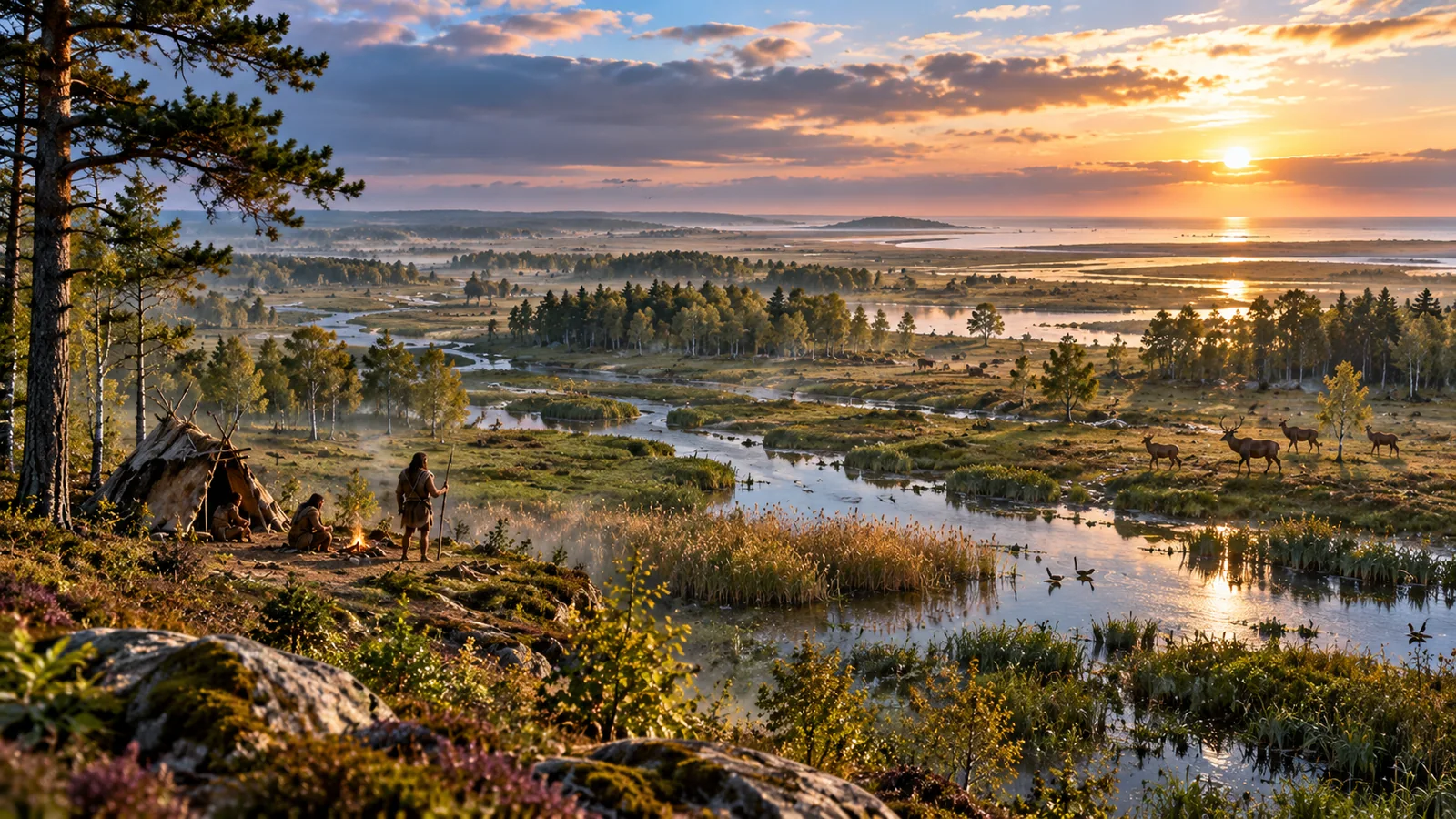
Stand on the coast of eastern England, look out across the North Sea and picture the horizon with no sea in front of you. Instead, imagine rivers winding across low plains, patches of woodland, wetlands full of birds, and people moving between what are now Britain and continental Europe. For a remarkable part of prehistory, a vast, changing landscape really did occupy much of that seabed. Archaeologists call it Doggerland.
Doggerland was not an Atlantis-style sunken city, nor a single island that disappeared overnight. It was a broad, sometimes fragmented stretch of low-lying land whose geography changed as the last Ice Age ended and seas rose. Today, researchers trace its rivers and former coasts from underwater geophysical data, recover traces of animals and people from the seabed, and examine ancient DNA sealed in marine sediments. A March 2026 study published in Proceedings of the National Academy of Sciences reveals an unexpectedly rich and complicated ecological past.
The most interesting question is not simply where this lost country went. It is what kind of place Doggerland was, how people may have adapted as it shrank, and how scientists can distinguish a genuine clue from a captivating reconstruction. This guide follows the evidence—from a harpoon caught in a fishing net to sedimentary DNA and modern models of rising seas.
In brief: Doggerland connected parts of Britain and mainland Europe when sea levels were lower. Sea-level rise transformed it over thousands of years; the Storegga tsunami was a major episode but was not a one-wave explanation for the entire disappearance. There is evidence of human activity and once-habitable environments, but no excavated, city-sized Doggerland civilization.
Where was Doggerland? A vanished landscape between Britain and Europe
Doggerland occupied areas now covered by the southern and central North Sea. Its boundaries were never fixed. At different moments it included river systems, broad plains, marshes, coasts, and later smaller islands and peninsulas. The modern Dogger Bank, an extensive, relatively shallow sandy feature in the North Sea, preserves the geographical name; it is not itself an intact ancient town or a single buried settlement.
The practical way to visualize it is to treat today’s North Sea map as a starting point—not as a time machine. The depth of the present seabed does not precisely reproduce ancient ground level. Deposits have accumulated, erosion has removed material, and the land itself has shifted or compacted. Researchers therefore reconstruct former surfaces using marine seismic data, cores, relative sea-level histories and corrections for geological change.
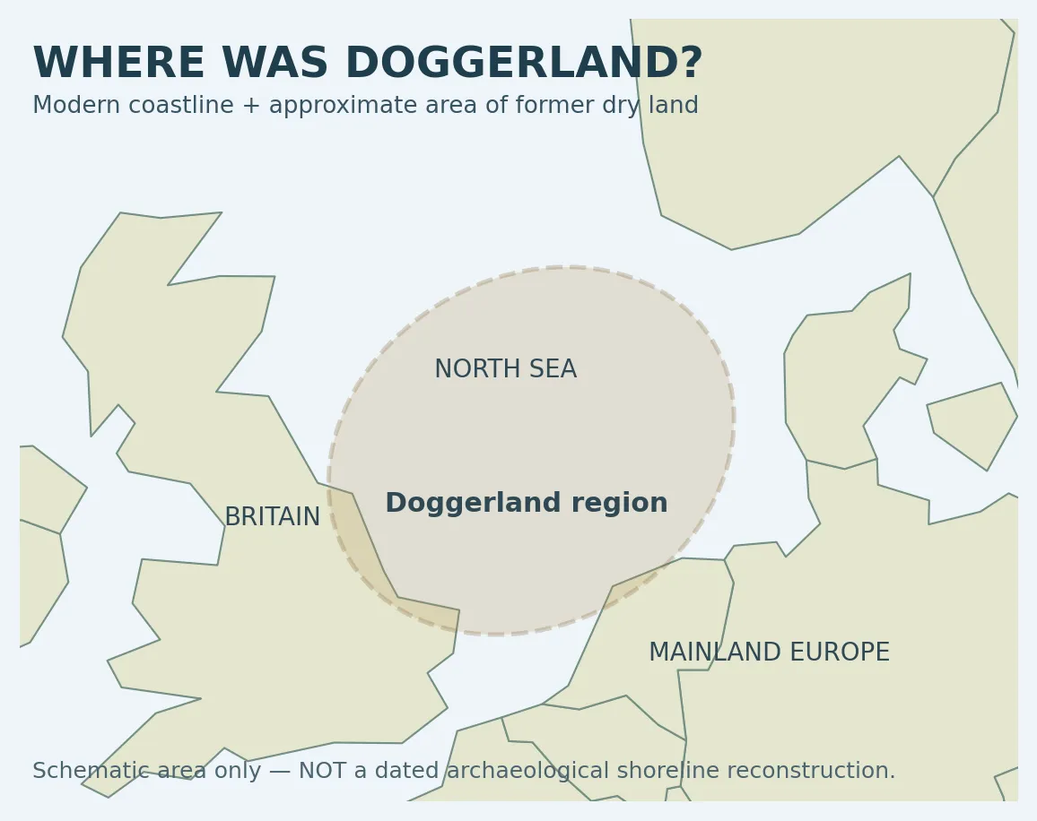
Research-based four-panel Doggerland coastline reconstruction (10,000–7,000 cal BP). Image: Merle Muru, from Walker, Gaffney, Fitch, Muru, Fraser, Bates & Bates, Wikimedia Commons, CC BY 4.0. The published map is a model; it does not depict a photographed historical shoreline.
For a scientifically published, dated series of coastline reconstructions, see the four-stage Doggerland map by Merle Muru and colleagues, reproduced from a peer-reviewed study. It illustrates dramatically changing geography at approximately 10,000, 9,000, 8,200 and 7,000 calibrated years before present. Map credit: James Walker, Vincent Gaffney, Simon Fitch, Merle Muru, Andrew Fraser, Martin Bates and Richard Bates, CC BY 4.0. The map is a research reconstruction, not satellite photography of a lost continent.
A brief timeline: from Ice Age plain to the modern North Sea
Dates need careful reading. In archaeology, cal BP means calibrated years before present, where “present” is conventionally 1950. A sea-level map dated 8,200 cal BP therefore points to roughly the mid-sixth millennium BCE, not to the year 8,200 BCE. Broad popular timelines simplify a complicated sequence that varied by location.
| Approximate period | What was changing | What the date does—and does not—mean |
|---|---|---|
| Around the last glacial maximum (~20,000 years ago) | Much more water was locked up in ice sheets; large parts of today’s shelf were exposed. | The entire region was not necessarily a uniform forest or a permanently ice-free refuge. |
| Early Holocene (~11,700 years ago onward) | Climate warmed; ice melted; rivers, habitats and shorelines moved. | Inundation was regional, not a single synchronized event. |
| ~10,500–10,000 cal BP | A 2024 inundation model suggests substantial areas in parts of the southern North Sea were lost relatively early. | The result is model-based and depends on reconstructed elevations. |
| ~9,000–8,200 cal BP | Remaining areas included increasingly fragmented coastal and island settings. | The Storegga tsunami occurred within a longer story of rising sea levels. |
| After ~8,200 cal BP | Former lowlands continued to become sea, shoals and changing coastal margins. | A single “date when Doggerland sank” is misleading. |
A 2024 paper in Quaternary International used improved palaeo-elevation data, estimates of relative sea level, and radiocarbon information to argue that significant land loss may have happened earlier than some older maps suggested. The exact shapes of the ancient coastline remain subject to revision as mapping methods improve. This is why dates quoted by museums, news reports and scientific papers may not always be identical.
What did Doggerland look like when people lived there?
It is tempting to draw one perfect landscape filled with deer, hazel trees and a sparkling river. The evidence describes something more varied. Doggerland could be open and cold in some glacial phases, then become a mosaic of grassland, freshwater systems, woodland and wetland as conditions warmed. One site and one layer cannot represent a region that existed over so many thousands of years.
Rivers, lakes, marshes and resources
Seismic surveys reveal channels and valley patterns beneath modern seabed deposits. A large prehistoric drainage system sometimes called the Southern River has become important for environmental sampling. In a landscape where fresh water and migrating animals were available, hunter-gatherers could find fish, birds, edible plants and other resources. But a convincing reconstruction needs to distinguish ecological potential from proof that any specific campsite existed at any specific location.
Bone and antler artefacts found in the North Sea point to hunting and technological skills. A study of Mesolithic human remains recovered from the seabed used chemical isotopes to investigate diet and found a significant freshwater fish component among individuals represented in its sample. It also highlighted how freshwater dietary effects complicate radiocarbon dating. The lesson is that even a human bone does not give a perfectly simple calendar date.
What a 2026 DNA study changed
In March 2026, researchers from the University of Warwick and collaborators reported a reconstruction of habitats along the Southern River using sedimentary ancient DNA (sedaDNA): genetic fragments left in mud, silt and other deposits. The team analyzed 252 samples from 41 marine cores. It identified evidence of temperate trees—including oak, elm and hazel—in deposits associated with periods earlier than expected from some land-based records; it also reported the genus Pterocarya, a walnut relative long thought absent from north-western Europe.
The paper supports the possibility that local, relatively sheltered ecological refuges survived within the broader glacial landscape, challenging a simplistic picture in which every tree had to migrate north only after the ice retreated. The university describes implications for the long-standing puzzle of how trees recolonized northern Europe quickly after warming. But this is evidence about plants and environmental history, not the discovery of an unknown human city or a confirmed village in that core.
The researchers also showed why the ground a DNA fragment comes from matters. Fine sediments can preserve locally deposited genetic material much more reliably than coarse deposits where old particles may be washed in again. A positive tree-DNA signal in disturbed sand does not carry the same certainty as a signal from well-preserved layers. See the University of Warwick explanation and original PNAS article.
Who lived in Doggerland—and what proof survives?
Archaeological evidence supports the presence of prehistoric people in the former North Sea landscape, particularly during the Mesolithic, or Middle Stone Age. People in this part of Europe generally lived through hunting, fishing, gathering and movement across seasonal territories. They did not leave written records, so archaeologists piece together their lives from objects, bones, sediments and comparisons with better-understood land sites. Claims that Doggerland was a single prehistoric empire go far beyond the evidence.
The Colinda harpoon: a discovery in a fishing net
One famous clue emerged in 1931, when the trawler Colinda brought up a barbed antler point from peat in the North Sea, often described as a harpoon or fish spear. Its importance lies not in the romance of the find but in the simple fact that a crafted prehistoric object emerged from an area now underwater. The discovery helped make a submerged inhabited landscape harder to dismiss. The circumstances also show a limitation: an object trawled from the seabed usually does not arrive with the carefully recorded archaeological layers that a land excavation provides.
Brown Bank and the missing settlements
The Brown Bank, a sand ridge in the southern North Sea, has produced material of archaeological interest. Researchers from Bradford, Ghent and the Flanders Marine Institute launched systematic investigations using geophysics and sediment cores. The University of Bradford reported a hammerstone identified through targeted investigation in 2020, a valuable step beyond relying solely on accidental discoveries.
A hammerstone is evidence for human tool use or working activity in the region; it is not proof that researchers had excavated a complete village, street system or Stone Age capital. The distance between a plausible settlement location and a thoroughly documented settlement matters. Marine archaeology is expensive, currents can move objects, and seabed work does not always preserve precise context.
- Direct human traces: worked antler or stone, human bone and securely described archaeological material.
- Environmental traces: pollen, plant remains, animal remains, ancient DNA and sediment chemistry that suggest what the landscape supported.
- Landscape reconstructions: modeled river valleys, former ground surfaces and relative sea levels, which help direct research but do not prove a settlement.
- Artistic reconstructions: paintings or images useful for imagination but not independent archaeological evidence.
How scientists map a country that is under the sea
Modern underwater archaeology relies on several partially independent methods. Their power comes from overlap: a buried river channel may be mapped geophysically; cores may show when peat grew on its banks; organic material may be dated; and DNA may help identify former vegetation. The resulting model is stronger than any one measurement alone.
1. Seismic surveys reveal buried landforms
Survey vessels and existing offshore-industry datasets record reflected sound waves from layers beneath the seabed. Differences between layers help researchers trace surfaces, channels and changes in sedimentation. The European-funded Europe’s Lost Frontiers project reports the mapping of about 185,000 square kilometres of Early Holocene landscape data, illustrating the scale of this approach. This number refers to mapping coverage and is not an estimate of Doggerland’s exact size at one fixed moment.
2. Sediment cores recover the environmental record
Coring equipment pushes into seafloor sediments to recover narrow cylinders of layered material. Researchers can identify peat, mud, sand, microscopic fossils and organic remains. A peat layer may mark an environment where plants accumulated on land or in wet marshy settings; a marine sediment layer above it can help establish how conditions changed. Layers can be eroded or mixed, so no single core should be treated as a simple, uninterrupted diary.
3. Radiocarbon and other dating methods build a sequence
Where suitable organic materials survive, radiocarbon dating can constrain their age. Scientists then calibrate radiocarbon measurements and integrate multiple dates with stratigraphic evidence and sea-level models. An old bone caught in a fishing net may have a precise laboratory result but uncertain original position. A properly documented core layer may provide better contextual evidence despite its very limited physical size.
4. Ancient DNA and microscopic fossils reveal habitat change
Sedimentary ancient DNA can register organisms that never left recognizable large fossils. It works alongside pollen, diatoms, molluscs and sediment chemistry; each responds differently to transport and preservation. The Unpath’d Waters project also developed an interactive landscape simulation using these kinds of marine and geophysical evidence. The simulation lets users explore different times, but its images remain scientific models rather than recordings of historical reality.
| Evidence type | What it can tell us | What it cannot establish alone |
|---|---|---|
| A worked stone or antler tool | People used technology in the broader region. | The population size or location of a permanent village. |
| Seismic image of a buried river | Likely position and geometry of an ancient channel. | That a camp existed on its banks. |
| Peat and sediment layers | Changes from land or marsh to marine conditions. | An exact regional flood date without wider modeling. |
| Sedimentary ancient DNA | Possible local plants and ecological change. | An identified human culture or a specific individual. |
| Palaeocoastline simulation | A testable scenario for changing geography. | An exact snapshot of the shore on one calendar day. |
Did a giant tsunami destroy Doggerland? The Storegga story
Around 8,200 years ago, a huge submarine landslide off Norway triggered the Storegga tsunami. Geological records show that waves affected coasts around the Norwegian and North Seas. The disaster is real; the claim that it destroyed all of Doggerland in a single day is far less secure. By then, long-term sea-level rise had already transformed much of the original lowland area.
An important study in Antiquity examined evidence from the southern North Sea and asked whether local topography may have either amplified or protected areas. A later archaeological review in Frontiers in Earth Science emphasized that tsunami consequences depend on where people lived and how communities responded. A tsunami did not cause the permanent, millennia-long increase in sea level.
A useful distinction: permanent flooding versus a temporary wave
Relative sea-level rise shifts the boundary between land and sea over long periods as ocean volume and land elevation change. A tsunami is a short-lived wave or series of waves that may overrun coastal areas and deposit sediment or damage settlements. The two can interact: a region already reduced to low islands and wetlands could be vulnerable to an extreme wave. But even a severe tsunami does not automatically create a new permanent coastline unless longer-term sea level and land conditions support it.
The evidence-based conclusion: Storegga probably posed a serious, unevenly distributed coastal hazard. Doggerland’s disappearance was principally a prolonged landscape transformation, not a proven single-day extinction of all its people.
What happened to Doggerland’s people?
No historian can reconstruct an individual family’s final journey with confidence. Some inhabitants may have moved as freshwater areas became tidal, hunting territories shrank or migration routes changed. Others could have continued using increasingly fragmented coastal land before abandoning particular places. Such possibilities are consistent with hunter-gatherer mobility, but their details are not directly observed in a continuous archaeological record.
The bigger picture matters: as Britain became separated from the continent, routes for animals and people changed, local ecological zones were rearranged and new coasts emerged. Ancient population history in north-western Europe cannot be reduced to one evacuation from a legendary land. The timing and consequences of separation were geographically uneven.
Modern archaeology also cautions against assuming an uninterrupted, densely settled Doggerland population merely because an ancient landscape could support resources. The 2024 inundation-and-radiocarbon analysis explores patterns of archaeological data, yet preservation and accessibility strongly influence how many dated finds survive. Absence of finds beneath a modern shipping route is not proof no one was ever there.
Five claims about Doggerland: what is verified and what is speculation?
| Popular claim | Evidence-based assessment |
|---|---|
| “Britain was connected to mainland Europe.” | Yes. Extensive exposed land occupied parts of the modern North Sea at lower sea levels. |
| “Archaeologists found human-made objects under the North Sea.” | Yes, including worked antler and stone; the context and reliability vary by find. |
| “Doggerland was one island that sank in a day.” | No. It evolved through thousands of years of inundation and fragmentation. |
| “A tsunami definitely killed the entire population.” | Not established. Storegga affected coasts but impact varied; no evidence supports a complete regional extinction claim. |
| “2026 DNA evidence discovered a lost civilization.” | No. The study reconstructed plants, river habitats and possible ecological refugia, not a city. |
What makes the March 2026 research genuinely new?
Earlier popular accounts often led with a simple sequence: dry land, rising water, a final giant wave. The March 2026 PNAS study adds a different perspective by addressing which plants might have survived in the region much earlier than expected. Researchers investigated ancient river sediments across an extended timespan rather than relying only on coastline outlines. Their work suggests pockets of suitable woodland habitat may have existed even through stages of the Ice Age.
That changes the kinds of questions scholars can ask. If temperate trees persisted in nearby refuges, where might animals have found food? Which river corridors were ecologically productive? Could certain resources have been available during periods formerly imagined as uniformly hostile? These are research avenues, not automatically verified reconstructions of a human settlement. The study’s explicit distinction between well-preserved DNA and reworked DNA is itself a valuable methodological advance.
For a reader, the comparison is straightforward: coastline models explain where the ground may have been above sea level; ancient DNA helps explore what could have grown there. Neither method, by itself, tells us what any one person was thinking, eating on a particular day or building in a particular valley.
Can you visit Doggerland—or see real finds?
There is no preserved above-water archaeological park called Doggerland that a visitor can walk around. Dogger Bank lies offshore, and disturbing or searching the seabed is not a casual sightseeing activity. The safest and most informative ways to explore are through research collections, museums, university publications and online reconstructions.
- Interactive landscapes: Explore Historic England’s Lands Beneath the Sea project to understand how scientists visualize change through time.
- Research mapping: Read the European Commission’s summary of Europe’s Lost Frontiers for mapping, coring and DNA research.
- Coastline images: Compare the peer-reviewed four-stage map; remember it is a dated research reconstruction, not a permanent outline.
- Evidence of people: Read the University of Bradford’s Brown Bank hammerstone report for a concrete example of investigating activity beneath the sea.
Why Doggerland still matters beyond its mystery
Doggerland illustrates an important scientific truth: coasts are temporary boundaries in geological time. What appears to be deep historical separation between Britain and Europe was once a changing landscape of terrestrial connections, river systems and coastal movement. Yet the story should not be used as a simplistic comparison with today’s sea-level risks. Ice-sheet retreat, local subsidence, modern coastal engineering and human settlement patterns differ substantially across periods.
Its value for science is threefold. For archaeology, it expands the map of where prehistoric people may have lived. For environmental history, it preserves records of how plants and wetlands responded to major climate shifts. For research methods, it forces geologists, biologists and archaeologists to work together, because no single dataset can recover a lost landscape alone.
There is also a broader comparison worth exploring: evidence of other drowned prehistoric places is appearing in different parts of the world. Horus Valley’s report on submerged prehistoric landscapes at Murujuga, Australia provides another example of how sea-level change can cover locations once used by people—although the geography, archaeology and community histories are very different. Likewise, our White Sands footprints analysis shows how sediment layers constrain claims about much older human activity.
Conclusion: a real lost world, and a story that keeps changing
Doggerland is more compelling than a tale about an imaginary Atlantis because it can be investigated. We have evidence of ancient landscapes, peat, river valleys, animal remains, worked materials and human activity. Researchers can now recover traces of trees from sediments collected beneath open water—and evaluate whether those traces stayed in place or arrived after being reworked.
What we do not have is a complete map showing every ancient village or proof that one enormous wave wiped out a unified population. The best answer is both less sensational and more interesting: an expansive world between Britain and Europe slowly became an archipelago, coast and seabed while humans and ecosystems faced changing opportunities and risks. Each new survey and sediment sample makes that lost world a little less invisible.
Sources and further reading
- Allaby and colleagues, PNAS (2026): Early colonization before inundation … revealed by sedimentary ancient DNA — primary research on 252 samples, 41 cores and the palaeoecology of Southern Doggerland.
- University of Warwick (2026): Doggerland had habitable forests during the last Ice Age — accessible explanation of the latest findings.
- Quaternary International (2024): Early Holocene inundation of Doggerland and its impact on hunter-gatherers — improved inundation reconstruction and radiocarbon analysis.
- Antiquity (2020): A great wave: the Storegga tsunami and the end of Doggerland? — evidence and interpretation of the tsunami.
- Frontiers in Earth Science (2021): Evidence of the Storegga Tsunami 8200 BP? — archaeological review and regional impacts.
- European Commission CORDIS: Europe’s Lost Frontiers — results — geophysical mapping, cores and environmental investigations.
- Historic England: The Lands Beneath the Sea — simulation and education resource.
- University of Bradford: Brown Bank hammerstone find — human tool evidence.
- Walker et al., Doggerland coastline reconstruction map, Wikimedia Commons — CC BY 4.0 visual resource and attribution.
You may also like
 History & Archaeology
Ancient Egypt’s Mining Map: How Egyptians Charted Roads, Rocks and Gold
Explore the Turin Papyrus Map, the ancient Egyptian record of Wadi Hammamat, quarry routes, rocks and gold.
 History & Archaeology
23,000-Year-Old Footprints at White Sands: New Evidence of Human Life and Climate Change During the Ice Age
New 2026 research dates the White Sands human footprints to 23,500–21,700 years ago and reveals an abrupt Ice…
 History & Archaeology
A 75,000-Year-Old Neanderthal Spear Wound: What Shanidar Cave Reveals About Violence, Care and Burial
New Shanidar Cave research documents a probable fatal 15-mm spear wound in a 75,000-year-old Neanderthal, earlier facial trauma…