
23,000-Year-Old Footprints at White Sands: New Evidence of Human Life and Climate Change During the Ice Age
New 2026 research dates the White Sands human footprints to 23,500–21,700 years ago and reveals an abrupt Ice Age shift in Lake Otero, plants and water availability.
Contents
- The discovery in context: why White Sands is different
- At-a-glance: what the newest research establishes
- What the October 2026 study actually discovered
- Why 20 layers matter
- The three different stories inside the sediment
- A giant lake where there is now a white desert
- From conifers to shrublands
- The retreat of Lake Otero
- An abrupt climate shock around 23,200 years ago
- What changing rainfall would mean for a family
- How can footprints be dated if the mud contains no calendar?
- Method 1: radiocarbon dating of aquatic seeds
- Method 2: radiocarbon dating of terrestrial pollen
- Method 3: optically stimulated luminescence
- Method 4: independent lake-sediment chronology
- What does “23,500 to 21,700 years old” mean?
- What kind of people made the footprints?
- Children and the traces of everyday life
- Mammoths, giant sloths and predators on the same shore
- Why co-occurrence matters
- Did people use a primitive transport device 22,000 years ago?
- How the track patterns are interpreted
- A timeline of the changing scientific evidence
- How does White Sands change the story of the peopling of the Americas?
- What about an ice-free corridor and a coastal route?
- Why Indigenous perspectives belong in this story
- Could the footprints disappear?
- Why researchers document the tracks so carefully
- What the evidence proves—and what it does not
- The uncertainties researchers continue to investigate
- The broader lesson: people experienced climate change long before written history
- Why this discovery matters beyond archaeology
- What readers should take away
- Scientific sources and further reading
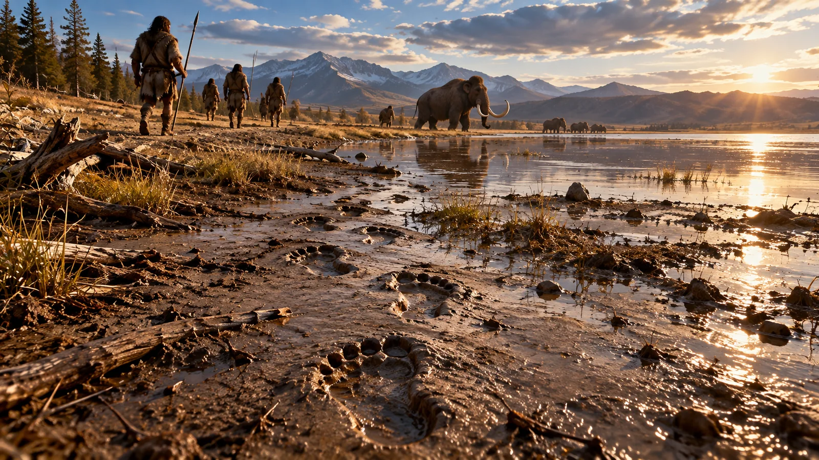
A line of human footprints pressed into ancient mud in New Mexico has preserved something more revealing than a momentary walk. It records people moving through a landscape that was repeatedly transformed by a shrinking lake, changing vegetation, and abrupt changes in water availability. A major study published on October 14, 2026, in Science Advances puts these traces into unusually precise environmental context, showing that people were present on the shores of ancient Lake Otero while their surroundings changed within spans comparable to a human lifetime.
The study, “Humans experienced abrupt environmental changes at White Sands during the Last Glacial Maximum,” describes 20 distinct footprint-bearing stratigraphic horizons and refines the site’s chronology to approximately 23,500–21,700 years ago. Those layers contain human tracks, traces left by Ice Age animals, and linear markings that researchers interpret as probable drag marks from a primitive carrying device. More importantly, the sediments preserve chemical and biological evidence of a dramatic shift from a lake-margin ecosystem toward the drier playa landscape familiar today.
There is a crucial distinction: the research did not establish that humans first arrived in the Americas exactly 23,500 years ago. It establishes a well-supported window of human activity at one location in present-day New Mexico. And the footprints do not show the people’s names, language, ancestry in genetic detail, or exactly why they were moving. This article examines what scientists actually measured, how the dates were tested, what daily life may have been like, and where the evidence still leaves questions unanswered.
The central discovery: The 2026 study combines 20 archaeological layers with improved radiocarbon dating, fossil pollen and chemical climate indicators. Together, they show humans navigating an ecosystem that shifted markedly between roughly 23,500 and 21,700 years ago. The precise timing of a footprint is not the same thing as the date of the first migration into the Americas.
The discovery in context: why White Sands is different
Today, White Sands National Park is famous for its brilliant white gypsum dunes. Visitors see a desert. But during the Last Glacial Maximum, the broader Tularosa Basin of southern New Mexico contained Lake Otero, a large body of water bordered by wetlands, exposed muddy ground, and plant communities much different from the modern desert.
The lake attracted animals; the shoreline offered places to walk and perhaps gather resources. Humans, mammoths, giant ground sloths and other animals left impressions as they moved over soft surfaces. Subsequent sediment deposition buried and preserved the impressions, which became trace fossils. When scientists excavate through the layers, they encounter a sequence of ancient surfaces rather than a single preserved afternoon.
The original White Sands findings, presented in Science in 2021, were controversial because a human presence more than 20,000 years ago challenged widely repeated timelines of settlement in North America. In 2023 and again in 2025, independent lines of dating evidence strengthened the age estimate. The 2026 study adds a new dimension: how the lake, climate and vegetation changed during the period in which the tracks were being made.
At-a-glance: what the newest research establishes
| Where were the tracks discovered? | White Sands National Park, Tularosa Basin, New Mexico | The track-bearing ancient lakebed is not generally open to visitors |
|---|---|---|
| When were the footprints made? | Approximately 23,500–21,700 years ago in the newly refined sequence | A range across layers, not the date of one person’s walk |
| What did researchers document? | 20 footprint-bearing stratigraphic horizons | A horizon represents a geological surface, not one identifiable family or event |
| What changed in the environment? | Lake-level retreat, changes in vegetation, and episodes of severe aridity | Local evidence does not reconstruct every aspect of global climate |
| How were ages checked? | Radiocarbon dating of concentrated conifer pollen and aquatic seeds, with stratigraphic modeling and earlier independent tests | All chronologies carry uncertainty intervals |
| Are the linear grooves proven vehicles? | They have been interpreted as possible travois-style drag traces | The wooden device itself was not discovered |
| Does this prove the first Americans arrived 23,500 years ago? | It supports people being there by that time | Their arrival could have been earlier and migration routes remain debated |
What the October 2026 study actually discovered
The research team expanded earlier excavations at White Sands and documented 20 stratigraphic horizons with tracks and other impressions. A stratigraphic horizon is a layer or former ground surface within a sequence of accumulated sediments. Treating these horizons separately helps scientists understand whether traces were deposited across an extended period rather than all at once.
The sequence includes footprints made by humans, animal trackways, and linear features that appear to have been drawn across soft ground. Crucially, the researchers paired archaeological observations with a high-resolution record of the landscape. Their paper reports a footprint chronology of 23.5–21.7 ka (thousand years ago) and a major dry interval associated with a climatic shift around 23.2 ka.
The team combined evidence that works on different scales. Footprint shape and location document movement across a surface. Pollen samples suggest what kinds of plants grew nearby. Biomarkers in the sediments help reconstruct moisture and vegetation changes. Radiocarbon dating assigns approximate times to particular sediment layers. Reading these records together produces a more informative history than dating a footprint layer in isolation.
Why 20 layers matter
Imagine finding a single muddy footprint after a rainstorm. It would demonstrate one crossing. Now imagine finding footprints separated by successive layers of mud, sand and silt, deposited as the shoreline shifts over long periods. The second situation shows repeated activity across changing conditions.
That is why the 20 horizons are so important. They reveal a sequence of preserved surfaces associated with human and animal movement. But they do not permit archaeologists to count 20 visits, reconstruct a continuous village, or identify the same group of people returning each year. Some surfaces may record numerous passages; gaps between preserved layers may conceal additional activity that left no lasting traces.
The three different stories inside the sediment
- Human behavior: footprints show that people traversed the exposed margins of ancient Lake Otero. Some track patterns elsewhere at White Sands have been interpreted as evidence of adults carrying children or humans following giant animals, but each interpretation requires its own support.
- An Ice Age ecosystem: impressions from mammoths, ground sloths and other animals demonstrate that the lake-margin habitat was used by multiple species, not just humans.
- Environmental transformation: changes in sediment types, pollen, chemical indicators and the lake’s margins show the landscape becoming drier and its plant communities changing through time.
A giant lake where there is now a white desert
The modern dunes are not a faithful picture of the ancient setting. Lake Otero filled parts of the basin during wetter phases of the Ice Age. Its shorelines expanded and contracted. At times, people could cross damp lake-margin ground firm enough to hold a footprint but soft enough to preserve the pressure of heels, toes and other features.
The National Park Service’s footprint account describes a landscape with grasslands, wetlands and a large body of water, supporting mammoths, ancient camels, giant sloths and predators. The 2026 study provides greater detail on the ecological shifts that followed.
From conifers to shrublands
Fossil pollen acts like a record of plants that once surrounded the area. Pollen grains can remain embedded in sediments long after the plants disappear. A changing mixture of pollen species can signal a change in the nearby vegetation, although it must be interpreted in light of pollen dispersal and preservation.
Researchers at the University of Arizona reported a shift from conifer-dominated vegetation toward sagebrush and oak steppe, with a relatively rapid transition involving pine, pinyon and juniper communities. They describe important changes taking place over approximately a century, a remarkably short period by Ice Age archaeological standards.
This matters because plants shape the food, shelter, fuel, and travel opportunities available to people and animals. A lakeshore with plentiful wetland vegetation is a different place from a drying basin with expanding exposed mudflats and scrub. People living through the transition would have encountered these practical differences, not simply an abstract change in a climate curve.
The retreat of Lake Otero
The 2026 study describes a transition from a more persistent lake toward a playa, a flat basin surface that is dry for much of the time and periodically wet. As water retreated, new areas of ground were exposed. Some surfaces became suitable for walking and preserved footprints when reburied. The exposed shoreline could also alter routes between water, plants and animal populations.
The research team reports that variations in pollen from Ruppia, an aquatic plant, track changing lake conditions over roughly 1,500 years. The broader dated footprint-bearing interval spans about 1,800 years. Both are approximate descriptions of a complex sequence; they should not be mistaken for evidence of one uninterrupted human occupation.
An abrupt climate shock around 23,200 years ago
One of the most striking results involves an episode of pronounced drying close to 23.2 ka, linked in the study to Dansgaard–Oeschger event 2. Dansgaard–Oeschger events are abrupt climate fluctuations identified in Greenland ice-core records. They show that the Ice Age climate was capable of moving quickly, even before modern human-caused warming.
At White Sands, evidence of drying comes from the sediment sequence and biological indicators. The University of Arizona research summary describes notable swings in water availability occurring within roughly a century and a change in plant communities within a similarly short period.
The link with Greenland records is scientifically important. It suggests the regional environment responded to broader climatic reorganizations. Yet the precise mechanisms by which North Atlantic changes affected rainfall in the American Southwest remain a research question. Timing correspondence is informative; it is not by itself a complete mechanism.
What changing rainfall would mean for a family
It is tempting to picture a family looking at a lake and watching it disappear. The footprints alone do not document such a specific scene, but the ecological changes are real enough to suggest practical consequences:
- A retreating shoreline could increase the distance to reliable water or shift which areas were accessible.
- Vegetation changes could influence where plant foods, animals and firewood were available.
- Harder or drier ground could alter routes across the basin and the likelihood that tracks would be preserved.
- New wetlands and exposed flats could bring opportunities as well as hazards, particularly when the surface was unstable.
- Changes in animal movements could reshape encounters between humans and large Ice Age mammals.
These are ecological implications, not directly witnessed events. The paper identifies the environmental changes; the exact human responses are hypotheses that would need additional archaeological evidence.
How can footprints be dated if the mud contains no calendar?
A footprint does not come stamped with a year. Archaeologists date the sediments and associated biological materials that surround or bracket it, then check whether the order and context of those ages make sense. White Sands has been especially informative because researchers have tested the chronology using several independent methods.
Method 1: radiocarbon dating of aquatic seeds
The 2021 dating used seeds of Ruppia cirrhosa found in relevant layers. Radiocarbon dating estimates when organic material stopped exchanging carbon with the environment. Because the seeds were positioned within or around the footprint-bearing sediments, their ages helped constrain when the tracks were formed.
But critics raised a serious concern: aquatic plants can absorb carbon that is older than the plant itself. This is sometimes called a reservoir effect or hard-water effect. If water contains old dissolved carbon, a seed can return an apparently older radiocarbon age. That possibility was a scientific reason to seek independent evidence rather than dismissing the discovery or assuming the first result was automatically correct.
Method 2: radiocarbon dating of terrestrial pollen
In 2023, researchers dated concentrated pollen from land plants to test the aquatic-seed ages. Terrestrial pollen provides a different carbon source and therefore addresses some of the criticism about old dissolved carbon. Specialized processing and flow cytometry allowed scientists to isolate very large numbers of pollen grains—on the order of 75,000 grains per sample in the earlier work.
The 2026 paper describes improved dating of conifer pollen, together with aquatic-seed ages, to build a more tightly resolved sequence. Agreement across these materials strengthens the proposed age rather than resting it on a single plant type.
Method 3: optically stimulated luminescence
Optically stimulated luminescence, or OSL, offers another kind of check. Certain mineral grains accumulate a radiation-related signal after burial. When tested in a laboratory, that signal can estimate when the grains were last exposed to light before burial, subject to assumptions about the sediment and radiation environment.
The 2023 Science study combined terrestrial pollen dating with OSL to test the original chronology. Its results supported a human presence at White Sands during the Last Glacial Maximum.
Method 4: independent lake-sediment chronology
A separate study published in 2025 reconstructed the chronology of ancient Lake Otero using additional sediment records and 26 radiocarbon determinations performed by two independent laboratories. Its findings supplied further support for the Last Glacial Maximum age of the track-bearing deposits. Read the open-access research.
| Aquatic seeds | Radiocarbon in seeds preserved in sediment | Gives ages closely associated with track layers | Potential old-carbon effects need evaluation |
|---|---|---|---|
| Terrestrial pollen | Radiocarbon in isolated land-plant pollen | Checks a different organic carbon source | Small carbon quantities require careful preparation |
| OSL | Light-reset signal accumulated by mineral grains | Independent test of sediment burial timing | Requires suitable sediment history and dose estimates |
| Lake-mud radiocarbon | Organic material in related lake sediments | Cross-checks the regional depositional sequence | Must demonstrate reliable stratigraphic connections |
| Multi-proxy 2026 model | Seed and pollen ages plus sediment order and climate proxies | Improves the time resolution of the footprint sequence | Modeled ages retain uncertainty and depend on assumptions |
What does “23,500 to 21,700 years old” mean?
The range covers the sequence studied, not every White Sands footprint in the wider park. The results are sometimes rounded to 23,000 years, a useful shorthand but less informative than the research interval.
The notation 23.5 ka means approximately 23,500 years ago, and 21.7 ka means approximately 21,700 years ago. These are scientific age estimates, not exact birthdays. Radiocarbon ages must be calibrated against changing atmospheric radiocarbon levels, and the estimated ages of layers include measurement and model uncertainty.
It also matters that multiple horizons accumulated over time. A track low in the stratigraphy can be older than one above it. Scientists evaluate that order using superposition, sedimentary context, dating, and tests for disturbance. The new precision is valuable because it allows environmental changes to be studied at a scale closer to the experiences of people who lived through them.
What kind of people made the footprints?
The marks were made by humans. Their precise cultural affiliation, personal identities, languages and biological relationships cannot be read directly from the shape of feet in mud. No DNA was extracted from these footprints to identify the people, and the study does not provide a complete account of how or when their ancestors entered the Americas.
Researchers can infer aspects of locomotion, track direction, approximate body size and sometimes whether a trackmaker was likely a child or adult, but each inference has uncertainties. Footprints can vary depending on body weight, gait, the softness of the ground, speed, and whether the track was distorted after its formation.
Children and the traces of everyday life
Earlier White Sands research includes long human trackways interpreted as an adult transporting a child, with small footprints appearing periodically beside a longer path. Those traces are compelling because they point to ordinary movements that stone tools and bones often fail to capture. The interpretation is not an eyewitness narrative; it arises from track patterns, spacing and physical deformation.
The National Park Service also discusses the apparent abundance of tracks made by younger individuals at excavated surfaces. One explanation is that children or teenagers handled some transport and movement tasks, though the representation of different ages may also be affected by where people traveled and which tracks survived.
The 2026 study adds the environmental backdrop to this earlier behavioral research. It tells us the lake-margin conditions were changing as generations of people made their way across the landscape.
Mammoths, giant sloths and predators on the same shore
The White Sands record includes traces of Columbian mammoths, giant ground sloths, ancient camels and predators. Such tracks place humans within an ecosystem rather than outside it. An animal track and a human footprint can occupy the same general landscape without being made at the same hour.
Some earlier sites show human tracks superimposed on giant-sloth impressions, motivating interpretations of close encounters or possible tracking behavior. But a fossil trackway alone generally cannot tell us whether a hunt succeeded, whether people were pursuing an animal, or whether the encounter was accidental.
Why co-occurrence matters
Co-occurrence demonstrates that people and Ice Age megafauna shared the basin over part of the relevant period. It does not prove humans caused the extinction of those animals. Megafaunal extinctions were complex processes, and the timing and relative roles of climate change, human activity and other factors remain debated for different species and places.
The value of White Sands is that it provides unusually direct evidence of movement by more than one kind of creature, preserved in the same broad sedimentary archive. The tracks complement—not replace—evidence from archaeological campsites, fossil bones and genetic studies.
Did people use a primitive transport device 22,000 years ago?
Another fascinating feature of the White Sands record is the occurrence of long, narrow grooves associated with human footprints. In a separate study published in 2025, researchers examined several types of linear trace, including single grooves and paired roughly parallel lines. They argued that dragging wooden poles or a simple travois-like device offers a plausible explanation.
A travois is a carrying or dragging arrangement using one or more poles. It could transport materials that would be awkward to carry by hand, although the precise shape and load of the proposed ancient device cannot be reconstructed from grooves alone.
The published research on linear traces considers alternative explanations and emphasizes the interpretation of the features as probable drag marks. The 2026 White Sands research includes linear traces as part of the archaeological sequence. That does not mean scientists found intact wooden poles, wheels, an animal-drawn cart or a surviving vehicle.
How the track patterns are interpreted
- Some narrow grooves follow roughly continuous routes through the sediment.
- Human footprints appear alongside and sometimes within the traced routes.
- In some examples, the spatial relationship between footprints and grooves supports dragging rather than an unrelated natural channel.
- Researchers have compared the geometry to tracks produced by dragging poles.
- Natural erosion, other human activities, and later modification remain alternatives to assess in individual cases.
What can responsibly be said: the features may represent an early form of human load transport. What cannot be said: the discovery conclusively proves wheeled transportation or identifies exactly what the people were carrying.
A timeline of the changing scientific evidence
| 2000s–2010s | NPS and collaborators investigated fossil tracks in the ancient lakebed | Human and megafaunal traces became a major research focus |
|---|---|---|
| September 2021 | First landmark dating study published in Science | Placed human activity around 23,000–21,000 years ago |
| October 2023 | Independent pollen and luminescence dating published | Answered key objections to the aquatic-seed chronology |
| January 2025 | Study of possible drag marks published | Raised the possibility of very early human transport technology |
| June 2025 | Independent lake chronology published | Added additional radiocarbon and stratigraphic support |
| May 2026 | USGS issued a detailed White Sands fact sheet | Summarized the overall archaeological and ecological evidence |
| October 14, 2026 | New Science Advances environmental study published | Documented 20 horizons, refined dates and rapid ecosystem changes |
The chronology reflects a research program that has been tested and expanded. It is more useful than describing the latest paper as a single shocking discovery that overturns everything in one day. The scientific argument has developed through independent dating, new excavation and analysis of environmental records.
How does White Sands change the story of the peopling of the Americas?
For a long time, simplified accounts of American prehistory centered on later archaeological cultures such as Clovis. As scientists identified older archaeological sites and improved dating, the idea of a single first migration immediately preceding those cultures became increasingly difficult to defend.
White Sands supplies especially striking physical evidence for people living in North America well before the end of the Last Glacial Maximum. If the tracks date to more than 21,000 years ago, humans were already present during a period when large northern ice sheets complicated possible travel routes.
The finding challenges oversimplified timelines, but it does not on its own determine which route people took, how many migrations occurred, or when the first arrivals happened. Different archaeological, genetic, geographical and environmental datasets must be combined to investigate those broader questions.
What about an ice-free corridor and a coastal route?
Researchers debate the timing and practicality of various movement routes into and through the Americas, including coastal travel and interior passages. The White Sands evidence increases the importance of examining routes that could have been available before and during major glacial advances. It does not identify a specific route in a footprint.
Similarly, the footprints are not evidence that every part of North America was continuously populated for the entire period. They document people in one region during a defined archaeological interval. The wider history is a large and still developing field of research.
Why Indigenous perspectives belong in this story
White Sands is not merely an abstract prehistoric data point. The site lies within landscapes connected to Indigenous peoples, and scholars and tribal partners have emphasized that the ancient human presence is part of a far deeper Indigenous history of the Americas.
University of Arizona anthropologist Edward A. Jolie, a co-author of the new paper and a member of Oglala Lakota and Hodulgee Muscogee communities, has highlighted how the findings relate to Indigenous histories and oral traditions. Responsible coverage should not present the ancient inhabitants as mysterious vanished outsiders disconnected from living Indigenous communities.
At the same time, identifying a precise modern nation or individual ancestry from footprints alone would go beyond the evidence. Meaningful engagement with tribal partners, respectful stewardship and distinctions between scientific inference and cultural knowledge are essential parts of the site’s continuing interpretation.
Could the footprints disappear?
Ancient tracks are fragile. Some are buried; others may become exposed through changing sediment conditions and then erode. A track can look strikingly distinct when first revealed but be altered by wind, water or physical contact.
The National Park Service states that the actual footprint sites are currently inaccessible to ordinary visitors. A visitor should not expect to hike directly to a 23,000-year-old human footprint or remove anything from the protected landscape.
An exhibit at the White Sands visitor center includes material explaining the tracks and casts that allow people to encounter the science without damaging the original surfaces. Visitors should check the park’s official information rather than trusting social-media directions to sensitive locations.
Why researchers document the tracks so carefully
- Detailed photography and mapping record the layout of tracks before further disturbance.
- Careful excavation and sediment logs connect tracks to geological layers.
- Sampling plans limit damage while collecting datable material and environmental proxies.
- Laboratory testing helps separate dates and measurements from visual interpretation.
- Preservation decisions balance scientific access with long-term protection and Indigenous interests.
What the evidence proves—and what it does not
The strength of the White Sands discoveries comes from their ability to support specific conclusions, not from turning every interpretation into certainty.
| Humans crossed parts of the Lake Otero margin more than 21,000 years ago | The date of the first human arrival anywhere in the Americas |
|---|---|
| Multiple track-bearing surfaces are preserved in the excavated sequence | That the same family occupied the site continuously for 1,800 years |
| Pollen and geochemical data record abrupt environmental change | The exact decisions each trackmaker made in response |
| Dates from several approaches support the Last Glacial Maximum chronology | A calendar-precise age for every individual footprint |
| The track record includes extinct megafauna | Proof that particular footprints document a successful hunt |
| Linear markings are consistent with plausible dragging technology | Discovery of an actual intact prehistoric vehicle |
| The site holds important evidence of early human activity | A complete reconstruction of the people’s language, culture or DNA |
The uncertainties researchers continue to investigate
Some questions concern dating precision: how exactly a layer formed, whether material was redeposited and which assumptions a particular chronological model requires. Others concern behavior: whether a groove was created by a dragged pole, whether tracks represent the same group, or why a route was used.
Environmental questions remain too. The new work describes the timing of a dry phase and vegetation shifts, but researchers continue to investigate the regional mechanisms connecting climatic changes across distant parts of the world. Additional sites are needed to learn how communities in other parts of the Southwest responded to similar conditions.
These uncertainties are not a flaw to hide. They define what future excavations, comparative studies and improved laboratory measurements can test.
The broader lesson: people experienced climate change long before written history
An easy mistake is to picture the Last Glacial Maximum as an unchanging frozen world. White Sands tells a more complicated story. Even during an era of vast ice sheets, particular regions could undergo marked environmental shifts, including changes in precipitation, vegetation and lake levels.
The newly resolved sequence allows scientists to see some of these shifts at scales relevant to human experience. The people whose feet left marks in the mud would have encountered water, plants and animals as practical realities. This is the human significance of the climate reconstruction: it moves from a generic statement that the Ice Age was cold to evidence of a changing local world.
There is also an important scientific boundary. Abrupt natural Ice Age climate change is not evidence against modern human-caused warming. The events occurred under different boundary conditions and require their own explanations. Studying them can improve knowledge of climate sensitivity and regional ecological responses, but it does not make their causes interchangeable with those of the present.
Why this discovery matters beyond archaeology
White Sands brings together several disciplines that rarely preserve their evidence in one location: archaeology, trace-fossil analysis, geochronology, hydrology, palaeobotany and climate science. Each provides a partial perspective. Joined carefully, they reveal a more textured narrative of humans and their environment.
For archaeologists, the tracks demonstrate human presence at a surprisingly early date and record actions that leave little other durable evidence. For geologists, the sediments trace the filling and draining of an ancient basin. For climate scientists, pollen and molecular biomarkers reveal rapid environmental transformation. For Indigenous communities and historians, the findings add another line of evidence to the deep time of human life in North America.
One thing the site cannot do is replace the rest of the archaeological record. The value of these footprints grows when they are compared with independent dates, other occupation sites, oral histories, environmental reconstructions and the many unresolved questions about migration and survival.
What readers should take away
The newest White Sands research is not simply another claim that footprints are very old. It is a higher-resolution account of an ancient landscape undergoing rapid change while humans repeatedly crossed it. The 2026 study places 20 archaeological horizons into a chronology of roughly 23,500–21,700 years ago and connects them with evidence of a shrinking lake, changing vegetation and severe drying.
The footprints provide direct evidence of human activity. The pollen and sediments reveal the environment in which that activity occurred. The proposed drag traces hint at everyday technology without proving an exact device. Taken together, these findings make the story of Ice Age America more human—and more scientifically detailed—than a single date could ever convey.
The strongest conclusion is also the clearest: people were living and moving around ancient Lake Otero during the Last Glacial Maximum, and the world around them did not stand still.
Scientific sources and further reading
The links below lead to original research, government documentation or reporting directly from the research institutions involved.
- Springer, K. B., and colleagues (2026). “Humans experienced abrupt environmental changes at White Sands during the Last Glacial Maximum.” Science Advances. Published October 14, 2026. DOI: 10.1126/sciadv.aeh0707.
- University of Arizona (2026). “Footprints in the (white) sand: Humans experienced abrupt environmental shifts during the last ice age.” Institutional report covering the methods and environmental findings.
- USGS (2026). Data release for the new White Sands environmental study. Supporting research-data record.
- Springer, K. B., and colleagues (2026). “Fossil footprints and Ice Age ecosystems of White Sands National Park.” USGS Fact Sheet 2025–3046. Government overview posted May 7, 2026.
- Pigati, J. S., and colleagues (2023). “Independent age estimates resolve the controversy of ancient human footprints at White Sands.” Science. Pollen radiocarbon and luminescence evidence.
- 2025 independent chronology study. “Paleolake geochronology supports Last Glacial Maximum (LGM) age for human tracks at White Sands, New Mexico.” Independent lake-sediment evidence.
- Bennett, M. R., and colleagues (2025). “The ichnology of White Sands (New Mexico): Linear traces and human footprints, evidence of transport technology?” Study of proposed drag marks.
- National Park Service. “Fossilized Footprints.” White Sands National Park. Official visitor and science information, updated August 2026.
- USGS (2023). Study confirms age of oldest fossil human footprints in North America. Summary of independent evidence.
- USGS (2021). Fossilized Footprints Reveal Human Habitation of North America Thousands of Years Earlier than Previously Thought. Original discovery announcement.
You may also like
 History & Archaeology
 Ancient Egypt’s Mining Map: How Egyptians Charted Roads, Rocks and Gold
Explore the Turin Papyrus Map, the ancient Egyptian record of Wadi Hammamat, quarry routes, rocks and gold.
 History & Archaeology
 A 75,000-Year-Old Neanderthal Spear Wound: What Shanidar Cave Reveals About Violence, Care and Burial
New Shanidar Cave research documents a probable fatal 15-mm spear wound in a 75,000-year-old Neanderthal, earlier facial trauma…
 History & Archaeology
 A Roman Pyramid Tomb in Egypt Reveals a 19-Line Greek Poem Mourning a Father
A Roman-period tomb in Egypt’s Dakhla Oasis preserves a 19-line Greek lament for a father, hieroglyphic protection spells…