
Ancient Egypt’s Mining Map: How Egyptians Charted Roads, Rocks and Gold
Explore the Turin Papyrus Map, the ancient Egyptian record of Wadi Hammamat, quarry routes, rocks and gold.
Contents
- The map that survived three millennia
- Where is the original map today?
- A royal expedition into the Eastern Desert
- Why Wadi Hammamat mattered
- How the ancient map used colour
- Gold, quarries and human landmarks
- How could Egyptians map terrain without satellites?
- Did the map have an exact scale?
- Why scholars call it a geological map
- The difference between ancient and modern maps
- What happened to the papyrus?
- What the map reveals about ancient Egyptian science
- What the map does not prove
- How to see and study the actual papyrus
- Conclusion
- Official and scholarly sources
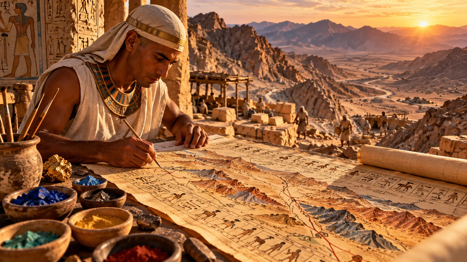
The map that survived three millennia
Long before aerial photography, satellite navigation and digital maps, an Egyptian scribe depicted a desert landscape with winding routes, distinctive rock formations and places where valuable stone and gold could be found. The surviving document, commonly called the Turin Papyrus Map or Goldmine Papyrus, dates to approximately 1150 BCE. Its significance is not that Egyptians possessed modern surveying instruments, but that they combined close observation of terrain with an exceptionally practical visual record.
Where is the original map today?
The papyrus is preserved in fragments at the Museo Egizio in Turin, Italy. The museum identifies it as one of the earliest known geographical maps. Its associated texts and archaeological history link it to the scribal community of Deir el-Medina. The museum notes that the scribe Amennakht, son of Ipuy, probably owned it and may have created it. Attribution is therefore a scholarly reconstruction, not an autograph signature conclusively establishing authorship.
A royal expedition into the Eastern Desert
The map belongs to the reign of Ramesses IV, of Egypt’s Twentieth Dynasty. Scholars associate it with an expedition to Wadi Hammamat, a major desert corridor between the Nile Valley and the Red Sea. The mission was closely linked to quarrying bekhen stone, a prized hard, dark stone used in royal sculpture and monuments. Gold deposits also appear on the map, but calling it simply a “gold mine map” overlooks the central importance of quarrying and transport.
Why Wadi Hammamat mattered
Wadi Hammamat was more than an isolated mining site. Its dry river valleys formed navigable passages through otherwise difficult mountains. Travellers, workers, officials and quarrying parties could use these corridors to reach stone resources and move between regions. The papyrus depicts a main valley with tributary routes, mountainous slopes and sites important to the expedition. Its depiction is selective: it emphasizes useful landscape information rather than every visible feature.
How the ancient map used colour
The document distinguishes rock formations with different colours and patterns. Museum descriptions and geological analyses identify dark and pink or reddish mountain zones corresponding to differing rock types, including sedimentary and igneous or metamorphic formations. Multicoloured dots in the valley depict varied gravels. This is why geologists regard the papyrus as more than a simple route sketch: it communicates the spatial distribution of geological materials.
- Desert wadis and routes
- Quarries and stone sources
- Gold-bearing locations
- Rock colours and valley gravels
- Human landmarks and hieratic labels
Gold, quarries and human landmarks
The map includes the bekhen-stone quarry, gold-bearing zones and a mining settlement associated with Bir Umm Fawakhir. It also depicts human landmarks such as a shrine, a commemorative stela and small buildings. Hieratic annotations provide context about locations and resources. Rather than inventing a hidden treasure code, researchers interpret these details as evidence of administration, practical navigation and resource knowledge.
How could Egyptians map terrain without satellites?
Ancient mapmaking did not require viewing the Earth from orbit. Surveyors and experienced desert travellers could observe the sequence of valleys, distinguish prominent hills, follow routes and record recognizable landmarks. Measurements, local expertise and repeated journeys could support a schematic plan. The precise workflow behind this individual papyrus is not fully documented, so no single technique should be presented as certain.
Did the map have an exact scale?
Not in the modern sense. The museum explains that the scribe straightened major bends in Wadi Hammamat so the route would fit on the papyrus. A single constant scale was not used. This matters because a map can be highly informative without preserving every angle and distance precisely. The Turin map is best understood as a purpose-built representation of the terrain, not a modern topographic survey.
Why scholars call it a geological map
In a 1992 study in The Journal of Geology, James A. Harrell and V. Max Brown compared the papyrus with the actual geology of Wadi Hammamat. They concluded that the coloured rock distributions, mineral deposits, quarry sites and wadi sediments make it the oldest surviving geological map known to scholarship. That description concerns surviving evidence: it does not prove that no earlier geological maps ever existed.
An ancient map could communicate practical geographic knowledge without being a satellite-style image of the Earth.
The difference between ancient and modern maps
Modern digital mapping uses satellite imagery, geographic coordinates, remote sensing and standardized geospatial data. The Turin Papyrus instead combined direct observation, symbolic shapes, selective labels and practical knowledge of a specific landscape. Its achievement is not technological equivalence with GPS; it is the sophisticated choice of which information mattered for an expedition.
What happened to the papyrus?
The map survived in fragments and reached Europe in the early nineteenth century as part of the Drovetti collection. Its reconstruction and interpretation have been refined by generations of Egyptologists and geologists. Because the document is fragmentary, the exact original arrangement and some readings remain subjects of study. The surviving fragments are valuable both as a map and as evidence of ancient scribal practices.
What the map reveals about ancient Egyptian science
The papyrus demonstrates close attention to the physical environment. Egyptian specialists could distinguish useful rock types, communicate travel corridors and connect resources to identifiable locations. It also shows how scientific knowledge and state administration overlapped: quarrying for royal monuments demanded organized labour, transport planning and reliable information about where materials could be found.
What the map does not prove
The map does not demonstrate that ancient Egyptians had satellites, aerial photography or unexplained technology. Nor does its depiction of gold mean it marks an undiscovered treasure deposit. Those interpretations go beyond the archaeological evidence. The remarkable reality is sufficiently compelling: skilled observers created a durable visual account of geology and routes over three thousand years ago.
How to see and study the actual papyrus
Start with the Museo Egizio digital collection, where the papyrus is catalogued and described. Compare its dark and pink mountains, branching valleys and written labels with modern descriptions of Wadi Hammamat. For the geological interpretation, consult the peer-reviewed 1992 paper. If using photographs of the artifact in an article, check the image-specific licensing and provide appropriate attribution.
Conclusion
The Turin Papyrus Map preserves a rare view of how ancient Egyptians understood their landscape. Its value lies in practical choices: distinguishing rocks, identifying quarries, marking routes and preserving knowledge in a form others could use. It is a striking reminder that cartography began with human observation and careful recording, long before modern technology transformed the field.
Official and scholarly sources
You may also like
 History & Archaeology
 23,000-Year-Old Footprints at White Sands: New Evidence of Human Life and Climate Change During the Ice Age
New 2026 research dates the White Sands human footprints to 23,500–21,700 years ago and reveals an abrupt Ice…
 History & Archaeology
 A 75,000-Year-Old Neanderthal Spear Wound: What Shanidar Cave Reveals About Violence, Care and Burial
New Shanidar Cave research documents a probable fatal 15-mm spear wound in a 75,000-year-old Neanderthal, earlier facial trauma…
 History & Archaeology
 A Roman Pyramid Tomb in Egypt Reveals a 19-Line Greek Poem Mourning a Father
A Roman-period tomb in Egypt’s Dakhla Oasis preserves a 19-line Greek lament for a father, hieroglyphic protection spells…