
Australia’s Lost Underwater Landscape: New Stone Tools Reveal Ancient Life at Murujuga
Newly documented underwater sites at Murujuga, Western Australia, reveal stone tools, ancient freshwater sources and clues to how First Peoples moved across a landscape flooded at least 9,000 years ago.
Contents
- What exactly was discovered in October 2026?
- Where is Murujuga, and why is it so important?
- A quick timeline: from dry land to underwater archaeology
- Site one: a freshwater spring now on the seabed
- Site two: a rocky hill above a former river channel
- Why the 23-kilometre stone connection is a major clue
- How can scientists determine where a stone tool originated?
- How old are the underwater artefacts?
- Did rising seas really drown a huge part of ancient Australia?
- How did archaeologists find stone tools beneath the ocean?
- How do researchers recognize a tool rather than a natural stone?
- What did earlier discoveries reveal in 2020 and 2023?
- An important scientific debate: could ocean processes have moved the stones?
- Is this evidence of a “lost civilization” or ancient underwater city?
- Why Indigenous Rangers are essential to the research
- Why UNESCO World Heritage status matters
- What might people have done across this ancient landscape?
- Why is underwater archaeology harder than archaeology on land?
- Could other parts of Australia hide similar drowned sites?
- What questions remain unanswered?
- What will researchers do next?
- The bigger story: Australia's ancient coastlines were lived-in places
- Primary studies, official sources and further reading
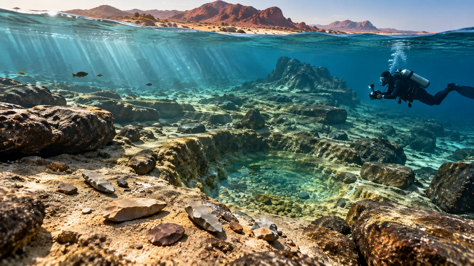
A seabed scattered with stones might seem an unlikely place to reconstruct ancient human history. Yet off the coast of Western Australia, researchers and Indigenous Rangers have identified evidence that people once visited freshwater sources, selected stone for tools and carried materials across a landscape that is now underwater. A study published on October 14, 2026, adds two archaeological locations to a growing record at Murujuga, also known as the Burrup Peninsula and surrounding Dampier Archipelago. The findings are important not because scientists found a mythical city, but because a familiar modern coastline hides a much older, extensively inhabited world.
In brief: The latest fieldwork documented more than 20 stone artefacts at two underwater locations in roughly 10–15 metres of water, according to contemporary reporting. One location is linked to an ancient freshwater spring; the other to a rocky hill near a former river channel. Geological comparisons indicate that stone used in some artefacts may have come from around Rosemary Island, approximately 23 kilometres away. The relevant landforms were submerged at least 9,000 years ago; that flooding date is not a direct laboratory date for each object. The work was carried out jointly with Murujuga Aboriginal Corporation Rangers and published in Quaternary Science Reviews.
Updated October 15, 2026. This evidence-led guide draws on the newly published study announcement, university reporting, earlier peer-reviewed research, UNESCO’s description of Murujuga, and published discussion of uncertainties in identifying underwater archaeological contexts. The featured image is an original artistic reconstruction, not an excavation photograph or a map of the sites.
What exactly was discovered in October 2026?
The October 14 paper is titled Underwater archaeological discoveries demonstrate raw material selection and transport of stone artefacts: new evidence from the submerged cultural landscape of Murujuga, Western Australia. Led by marine archaeologist Jonathan Benjamin and colleagues across several universities and Murujuga Aboriginal Corporation, it describes evidence from two further submerged locations. The discovery supports the interpretation that earlier underwater artefacts were not isolated curiosities: different places on an ancient terrestrial landscape retained traces of past human activity after the sea arrived.
The finds are stone artefacts, not skeletons, houses, written records or a stone-built city. Such objects can record how people used raw materials even when more fragile traces—wood, plant fibres, shelters and food remains—have not survived or have not yet been found. The October 14 coverage reports more than 20 artefacts across the newly documented sites. That count is separate from the hundreds of artefacts already reported in earlier investigations at Murujuga.
One location is associated with a now-submerged freshwater spring. The other lies near a rocky elevated feature overlooking what researchers interpret as a former river channel. Together they indicate that prehistoric residents used different kinds of places rather than relying on only one coastal activity area. These distinctions matter when archaeologists reconstruct patterns of movement, water access and resource collection.
Where is Murujuga, and why is it so important?
Murujuga is in the Pilbara region of north-western Western Australia. It includes the Burrup Peninsula, the nearby Dampier Archipelago and connected sea Country. The archipelago’s islands and channels are remnants of terrain that looked very different during lower sea levels. As oceans rose after the last Ice Age, dry land was progressively cut into islands, channels and underwater valleys.
This is also a living Aboriginal cultural landscape. The Ngarda-Ngarli are Traditional Owners and custodians whose cultural connections and responsibilities continue today. Murujuga is internationally recognized for its exceptionally extensive rock art, stone structures, archaeological sites and cultural knowledge. UNESCO added the Murujuga Cultural Landscape to the World Heritage List in 2025, recognizing both tangible heritage and enduring cultural traditions. The heritage landscape explicitly includes marine and submerged areas, not only famous rock engravings above water.
Describing the archaeological terrain as a “lost landscape” should therefore mean land physically inundated by the sea, not a forgotten people. Ancient activity survives in material evidence, continuing traditions and the knowledge held by contemporary communities. That distinction is central to interpreting this discovery responsibly.
A quick timeline: from dry land to underwater archaeology
- During the last Ice Age: Global sea levels were substantially lower because more water was stored in continental ice sheets. Parts of today’s continental shelf were habitable dry ground, although the coastline shifted over time.
- After the glacial maximum: Warming and ice melt contributed to rising sea levels. Rivers, springs, rocky ridges and routes across the future Dampier Archipelago were gradually affected by inundation.
- At least 9,000 years ago: The newly investigated locations had been submerged by approximately this time, according to the research team’s reported reconstruction. Their artefacts could have been made earlier.
- 2020: The Deep History of Sea Country research program reported major underwater Aboriginal archaeological discoveries near Cape Bruguieres and Flying Foam Passage.
- 2023: Follow-up work documented multiple confirmed stone artefacts associated with a submerged freshwater spring, strengthening the archaeological case for that setting.
- October 14, 2026: The new Quaternary Science Reviews study reported additional locations and analysis pointing to stone selection and transport across the former landscape.
These dates refer to different kinds of evidence. A publication date marks when scholars reported results; an inundation date constrains when land disappeared beneath the sea; and an artefact’s manufacture or use may be older, sometimes by an unknown interval.
Site one: a freshwater spring now on the seabed
A freshwater spring is an especially promising archaeological target. People and animals need reliable water, and an exposed spring can become a recurring point of movement and activity. Modern divers can find remnants of such features as depressions or distinctive geological structures beneath marine sediment and rock. Previous Murujuga research has investigated a similar setting in Flying Foam Passage at roughly 14 metres depth.
In the 2026 research, one of the newly documented sites is associated with another ancient freshwater source. The presence of stone artefacts nearby makes the landform more than an interesting geological object; it suggests people used the broader area when it was accessible. It does not by itself prove there was a permanent village, sacred building or year-round settlement directly beside the water source.
Archaeologists ask several practical questions at a spring: Are the suspected tools deliberately flaked? Are they located in a plausible prehistoric land surface? What type of stone were they made from? Could currents, storms or later disturbance have changed their position? The answers determine how confidently a site can be linked to pre-inundation human behavior.
Site two: a rocky hill above a former river channel
The second setting provides a different clue. A rocky hill or rise above an ancient river corridor is not the same environmental niche as a freshwater spring. Elevated locations may have offered views, routes across difficult terrain, opportunities to procure stone or places for specific activities. However, none of those individual purposes should be declared proven without stronger contextual evidence.
The newly described rocky location matters because it widens the emerging picture from one water-related focal point to a network of distinct places used within the same broad cultural landscape. Rivers and channels that are underwater today can function as guides for reconstructing where people could walk, find water and move resources when the ground was dry.
Together, the two locations allow a more nuanced interpretation than a simple headline about “ancient objects found underwater.” They represent different components of a terrain transformed by sea-level rise. Their archaeological value comes from context, not from their depth alone.
Why the 23-kilometre stone connection is a major clue
One of the most interesting results concerns raw material provenance: identifying where the stone in an artefact probably came from. The research announcement says some material appears to match stone from around Rosemary Island, roughly 23 kilometres from the new find locations. That comparison suggests people selected and moved workable stone across an area that is now fragmented by marine channels.
Imagine a person carrying a preferred rock across a valley, shaping a blank into a tool or taking a finished implement to another activity place. Stone can preserve clues about this mobility long after paths, temporary shelters and wooden equipment disappear. A geological source match is particularly useful when local rocks differ in texture, chemistry or microscopic characteristics from rocks elsewhere.
However, 23 kilometres is an approximate straight-line geographic separation between inferred source and find area, not a measured prehistoric walking route. The team has not traced the exact journey of an individual tool. Transport could have occurred in stages, across repeated visits or through exchange between people. A source attribution supports movement or connection; it does not prove a formal trade network, a particular group identity or the direction in which every object traveled.
How can scientists determine where a stone tool originated?
A visual resemblance is only a starting point. Archaeologists and geologists compare candidate source rocks with artefacts using characteristics such as grain size, mineral composition, inclusions, texture and surface weathering. Where appropriate they use petrographic microscopy and portable X-ray fluorescence, often abbreviated pXRF, to investigate mineralogical and elemental signatures.
The region has varied geology. Researchers can sample known exposures around the Dampier Archipelago and then compare those samples with individual artefacts. The goal is to rule out ordinary nearby rock sources and test whether a more distant outcrop provides a better geological match. A peer-reviewed 2025 study on Murujuga stone artefacts specifically discusses petrography and pXRF as provenance tools, providing useful scientific background for understanding the 2026 finding.
Even rigorous matching has limits. Two outcrops can share related geology, sampling may be incomplete and chemical signatures may overlap. A match is best described as a supported source interpretation rather than an infallible fingerprint. This distinction is especially important when a source location becomes the basis for claims about ancient migration or exchange.
How old are the underwater artefacts?
The careful answer is that the landscape was covered by rising sea levels at least around 9,000 years ago, while the manufacture dates of the individual stone artefacts remain less precisely established in the public reporting. Some pieces may be older than the inundation limit. It is incorrect to say that every tool has been individually carbon-dated to exactly 9,000 or 10,000 years old.
Most stone tools cannot be dated by ordinary radiocarbon methods, which generally require suitable carbon-bearing material. Archaeologists instead construct age limits through associated sediments, environmental reconstruction, sea-level curves, stratigraphy and, where available, datable organic material or other specialized techniques. If a tool was demonstrably deposited on land before the sea submerged that surface, inundation provides a latest possible age for its initial placement, subject to uncertainty about subsequent movement.
The distinction between an object being old and its current seabed position being undisturbed is significant. If a stone was transported by waves from a later location, then modern water depth alone would not establish a pre-inundation date. That is why site context and sediment movement receive so much attention in underwater archaeology.
Did rising seas really drown a huge part of ancient Australia?
Yes. During glacial periods, water held in large ice sheets lowered ocean levels, exposing broad areas of continental shelf. After the last Ice Age, the coast migrated inland as sea level rose. The Flinders University release notes that more than two million square kilometres of the Australian continental shelf were inundated. That scale helps explain why archaeologists expect the modern seabed to contain more than occasional dropped objects.
Not every part of this drowned area was necessarily occupied at the same time. Environments varied: some terrain was dry or poorly supplied with water, while coastal plains, waterways, estuaries and river corridors may have offered attractive resources. A submerged shelf is therefore a potential cultural landscape, not evidence for one enormous continuous village or city.
Murujuga offers unusually promising conditions because researchers can connect underwater geology with onshore archaeology, Indigenous cultural knowledge and a long sequence of changing coastlines. As the archipelago took shape, the relationship between communities and their Country changed, but the wider cultural landscape did not lose its meaning.
How did archaeologists find stone tools beneath the ocean?
Underwater archaeological discovery is normally a multi-stage process, not random diving. Researchers first look for seabed features that may have been attractive to people when exposed—freshwater springs, palaeochannels, sheltered surfaces, stone sources and elevated ground. Maps and geophysical data narrow the search area before scientific divers examine promising spots.
The Deep History of Sea Country program has used combinations of aerial and marine remote sensing, underwater bathymetry, sonar-style seabed mapping, geological interpretation and diver survey. Earlier research in Murujuga developed a multi-scale strategy: use broad mapping to understand the landscape, identify likely targets, then confirm suspected archaeology through direct underwater inspection and specialist stone-tool analysis.
Divers record positions and visible context, photograph or video potential objects and collect samples only under the permissions and research protocols required. Marine fieldwork is affected by tides, wind, currents, water clarity and safety limitations. A carefully mapped stone on the seabed can be more informative than an object collected without its location and surroundings.
How do researchers recognize a tool rather than a natural stone?
Broken rocks are common underwater. The presence of a sharp edge alone does not prove manufacture. Lithic specialists look for combinations of diagnostic flake scars, striking-platform characteristics, fracture patterns, deliberate retouch and repeated technological features. They compare finds with naturally broken samples and examine whether multiple artefacts form a coherent assemblage.
Context matters just as much as shape. A piece lying near a palaeospring and associated with other plausible artefacts may be more informative than a single ambiguous stone in mobile gravel. Researchers also need to consider whether surf, cyclones or currents could concentrate or move material after deposition.
What did earlier discoveries reveal in 2020 and 2023?
The latest study did not discover underwater Aboriginal archaeology in Australia from scratch. In a landmark 2020 paper, researchers described confirmed ancient underwater sites near Murujuga. At Cape Bruguieres, they recorded more than 260 lithic artefacts at shallow depths down to around 2.4 metres below sea level. At Flying Foam Passage, a separate artefact was found in association with a submerged freshwater spring at approximately 14 metres depth. The two localities showed different archaeological and preservation conditions.
A 2023 study returned to the freshwater-spring context in Flying Foam Passage and reported five stone artefacts within a submerged spring setting. That work strengthened the interpretation that such springs can preserve evidence of former human use and serve as predictive targets in other tropical coastal regions.
The 2026 research builds on those results rather than replacing them. It adds new locations and focuses strongly on the selection and movement of stone across a broader pre-inundation landscape. Confusing the new site’s count with earlier totals would distort what the latest study actually contributes.
An important scientific debate: could ocean processes have moved the stones?
A good explanation of this discovery must acknowledge that the integrity of some earlier Murujuga seabed artefact contexts has been debated in the peer-reviewed literature. In a 2025 paper in Geomorphology, Piers Larcombe and colleagues argued that items from earlier sites may have been reworked or transported by marine processes instead of remaining exactly where they were discarded on dry land. They questioned whether those examples could securely be called undisturbed pre-inundation deposits and stressed difficulties with direct dating.
A response published in Geomorphology in 2026 by Michael O’Leary, Jonathan Benjamin and colleagues contested that analysis. The response argued that the critics relied on insufficiently validated regional hydrodynamic modelling and shoreline interpretations that did not capture site-specific field conditions. The reply defended the archaeological interpretation and emphasized localized empirical evidence.
This is a scientific disagreement about depositional context and post-depositional movement, not a reason to dismiss Aboriginal history or to claim stone artefacts were never found. New locations, geological comparisons, detailed mapping and independent testing may help clarify which artefacts stayed near their original positions. A careful reader should distinguish observed objects, inferred prehistoric behavior and contested details of site formation.
Is this evidence of a “lost civilization” or ancient underwater city?
No. The sites are important precisely because they document real human activity without requiring extraordinary speculation. Archaeologists have not reported streets, palaces, temples, writing or evidence of an unknown technological civilization at these locations. Media phrases such as “lost world” describe dramatic environmental change, not a secret Atlantis beneath Australia.
The people who lived in these landscapes are not an extinct mystery population detached from today’s First Nations communities. The archaeological findings relate to ancestral Country whose significance is maintained through living cultural connections. Treating Indigenous archaeology as a story of anonymous “vanished civilizations” overlooks the human continuity recognized in UNESCO’s World Heritage assessment.
What the evidence supports is already remarkable: ancestors lived across now-submerged terrain, interacted with distinct places and used or carried stone materials. Scientific understanding becomes stronger, not weaker, when the limits of the evidence are stated clearly.
Why Indigenous Rangers are essential to the research
The 2026 project combined academic underwater archaeology with the expertise and continuing cultural responsibilities of the Murujuga Aboriginal Corporation. Local Rangers trained as scientific divers, participated in surveying and made discoveries. The latest paper includes Ranger co-authors, reflecting their contribution to the research rather than treating Traditional Owners as observers on the sidelines.
The university and Indigenous reporting identify Rangers Malik Churnside and Richard Variakojis among the people involved. Researchers have emphasized that knowledge of Country, coastal features and cultural values shapes where to investigate and how evidence should be interpreted. Collaboration is both scientifically productive and ethically important when studies concern Aboriginal cultural heritage.
Murujuga is living Country, not an abandoned laboratory. Research should follow custodial protocols, manage sensitive location information appropriately and avoid encouraging souvenir collection. Archaeological objects and underwater heritage are not free items for divers to remove.
Why UNESCO World Heritage status matters
Murujuga was added to UNESCO’s World Heritage List in July 2025. The designation recognizes its exceptional rock art and a cultural landscape spanning land, sea and submerged areas, with long-term Ngarda-Ngarli connections to Country. That status helps make the scientific and cultural stakes of the 2026 underwater discoveries easier to understand.
World Heritage inscription does not mean every newly found artefact has the same archaeological date, nor does it automatically prohibit all development in the wider region. It does underscore the need for heritage management, consultation and careful monitoring. UNESCO’s official site description notes that cultural protection combines the authority and responsibilities of Traditional Owners with Australian heritage-law frameworks.
As knowledge of submerged sites expands, planners and researchers face practical questions about seabed disturbance, marine infrastructure, shipping activity, industrial development and future surveys. Preserving the context around objects may matter as much as protecting individual finds.
What might people have done across this ancient landscape?
The new evidence is compatible with people moving through a connected landscape and obtaining or carrying useful stone over significant distances. Freshwater places could have supported visits and daily activities, while higher ground and former river corridors could have formed different parts of movement patterns. These are reasonable contextual interpretations, not direct eyewitness descriptions of a particular journey 9,000 years ago.
Stone tools often supported cutting, scraping, processing materials and preparing other equipment, but a tool’s precise purpose depends on its morphology, microscopic wear and residue studies. The October 2026 public summaries do not establish that every artefact served one specified task. A robust reconstruction therefore separates general possibilities from use-wear analyses actually completed by researchers.
The most useful change in perspective is to picture an interconnected mosaic of freshwater sources, rocky places, pathways and coastal resources. The present-day sea hides their continuity. Archaeology can recover fragments of that geography even when it cannot recreate every aspect of everyday life.
Why is underwater archaeology harder than archaeology on land?
On land, an excavated object may sit within visible soil layers, hearths or constructed features. Underwater, archaeologists must contend with marine sediment, biological growth, erosion, storm disturbance, changing visibility and limited diving time. A single object may have a complex post-depositional history. Equipment and safety costs also limit how much of the seabed can be inspected directly.
Some environments preserve exceptional material; others expose and scatter objects. Coastal development can disturb heritage long before researchers know it exists. That is why scientists combine several kinds of evidence: geophysical landscape mapping, rock geology, artefact technology, paleoenvironmental reconstruction, and Traditional Owner knowledge.
It is also why sweeping claims about finding “thousands of sites” should be read as potential or predictions, not an inventory of thousands of fully excavated, confirmed archaeological sites. Much of the continental shelf has never received the kind of targeted investigation used at Murujuga.
Could other parts of Australia hide similar drowned sites?
Almost certainly more archaeological traces remain to be discovered, although their locations, age and preservation vary. The Australian continental shelf is extensive, and post-glacial sea-level rise affected numerous coasts. Places where researchers can identify former freshwater supplies, sheltered terrain, river channels and stable surfaces may be particularly promising for future investigations.
The methods are relevant beyond Western Australia. The 2023 Murujuga study proposed that submerged springs in tropical coastal settings could be useful targets, including in regions with mangroves, deltas and reef-related landforms. Similar archaeological questions arise worldwide wherever rising seas covered formerly inhabited terrain.
However, the existence of a drowned coastline does not prove that particular sites survived. Strong currents, sediment movement and human disturbance may destroy or obscure some evidence. Each claim ultimately depends on local data and careful assessment of artefacts in context.
What questions remain unanswered?
- Exact manufacture dates: Can future work better constrain when particular tools were made or placed in their original contexts?
- Movement and source attribution: How many artefacts were transported from distant geological sources, and can alternative source areas be ruled out?
- Site integrity: Which objects remained close to their original positions after marine flooding, and which might have moved?
- Activity patterns: Were the locations used briefly, repeatedly or for different tasks over long spans?
- Landscape reconstruction: How did springs, valleys and coastlines change during the relevant periods of settlement and inundation?
- Survey scale: How many additional sites can be documented without putting vulnerable heritage at risk?
- Cultural stewardship: How can research and protection continue under the guidance and priorities of Traditional Owners?
These uncertainties are research opportunities rather than flaws to conceal. The study’s strongest contribution is a growing body of interpretable evidence, not a claim that every part of ancient life has been solved.
What will researchers do next?
Further work can expand seabed mapping, test additional palaeospring and river-channel candidates, compare artefact geology with wider source samples and investigate local marine sediment dynamics. Researchers may seek more precise contextual dates where suitable material exists and refine methods for determining whether objects remained in their original terrestrial positions. All such steps depend on funding, safety and the permissions of custodians.
The partnership model is important for future work. Murujuga Rangers bring knowledge of Country and experience on the water; archaeologists bring specialized tools for mapping, geological comparison and lithic analysis. Researchers can also publish findings without publicizing sensitive coordinates of fragile sites.
The field is still at an early stage relative to the size of the drowned landscape. New fieldwork may change interpretations, including how artefacts were transported, how sites formed and how ancient coastlines were used. Responsible reporting should leave room for that change.
The bigger story: Australia’s ancient coastlines were lived-in places
It is easy to see the present coast as a permanent boundary between land and sea. Archaeology shows why that assumption is misleading. During earlier periods, people moved through valleys that are now channels, encountered springs that now lie underwater, and used landscapes whose shape cannot be inferred from modern beaches alone.
The 2026 Murujuga work offers a particularly tangible example: artefacts documented in different underwater settings and evidence that some useful stone may have traveled approximately 23 kilometres. Those clues are small in physical size, but they help reconstruct movement and decision-making across a much larger geography.
The enduring story belongs to First Peoples and their Country. The latest discoveries are an addition to a long record of Aboriginal presence and cultural stewardship, not the rediscovery of a vanished civilization. As more seabed sites are studied, Australia’s archaeological map will increasingly include places that modern maps color blue.
Primary studies, official sources and further reading
- Benjamin and colleagues, Quaternary Science Reviews (2026): new Murujuga underwater stone artefact discoveries; DOI 10.1016/j.quascirev.2026.110307.
- Flinders University, October 14, 2026: Australia’s oldest underwater archaeology reveals ancient life within a lost landscape.
- ABC News, October 14, 2026: newly discovered underwater sites off Western Australia’s Burrup Peninsula.
- UNESCO World Heritage Centre: Murujuga Cultural Landscape, inscribed in 2025.
- Benjamin and colleagues, PLOS ONE (2020): Aboriginal artefacts on the continental shelf reveal drowned cultural landscapes.
- Benjamin and colleagues, Quaternary Science Reviews (2023): stone artefacts at a submerged freshwater spring.
- Larcombe and colleagues, Geomorphology (2025): critical reappraisal of earlier underwater artefact contexts.
- O’Leary and colleagues, Geomorphology (2026): reply concerning site integrity and hydrodynamic modelling.
- Murujuga Aboriginal Corporation, 2020: Aboriginal-led collaboration and early underwater finds.
You may also like
 Science & Discoveries
James Webb Finds Metal-Rich Gas Around the Milky Way’s Black Hole: What It Means
James Webb observations reveal metal-rich gas near Sagittarius A*. Here is what the finding means, how infrared spectroscopy…
 Science & Discoveries
NASA Found a Giant Musical Symbol in Space: The Science Behind the Cosmic Treble Clef
NASA’s Treble Clef is a distant radio phoenix, not music in space. Learn how black-hole plasma and galaxy-cluster…
 Science & Discoveries
2026 El Niño Explained: What NASA Satellites Reveal About Winter 2026–27
NASA satellites reveal a powerful 2026 El Niño. Decode the ocean maps, NOAA winter 2026–27 forecast, UK and…